Tropical Storm Isaias forecast to become first Atlantic hurricane of 2026
El Niño has led to an eerily quiet season so far but the first Atlantic hurricane of the year is now set to impact the southern USA.
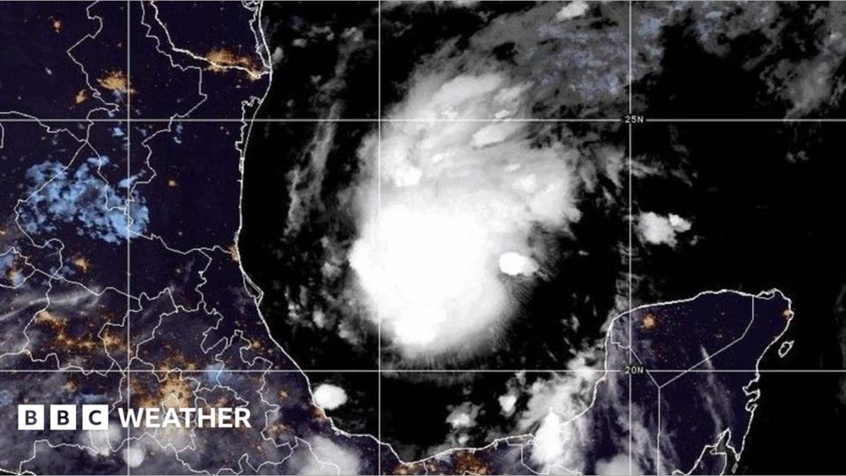
Tropical Storm Isaias has formed in the Gulf of Mexico and looks likely to strengthen into the first Atlantic hurricane of this year.
It is expected to reach hurricane strength by Thursday morning with forecasts suggesting it could then intensify to a category two storm.
It has the potential to bring damaging winds, torrential rain and a storm surge to parts of the US Gulf Coast with landfall expected on Friday or Saturday. Hurricane and Storm Surge Watches have been issued.
Isaias will bring an end to the lack of hurricanes that has led to a record-breakingly quiet Atlantic season so far with development suppressed by the growing El Niño pattern .
Developing El Niño becomes strongest on record weeks before expected peak
In its latest update, the US National Hurricane Center estimates that Tropical Storm Isaias is likely to reach hurricane strength by the start of Thursday. It will intensify further, reaching category 2 by Friday morning.
Parts of Mexico will feel the first impacts as the storm swirls out at sea, with 4in (100mm) of rain possible around the Bay of Campeche and the Yucatan Peninsula, accompanied by strong winds.
Isaias will then make landfall on the Gulf Coast - probably in Louisiana, Mississippi, Alabama or Florida - late on Friday or early on Saturday.
Between 3 and 6in (75-150mm) of rain could fall across the Gulf Coast, from south-east Louisiana to north-west Florida.
A few places could see up to 10in (250mm) with possible flash flooding, especially in urban areas, and the risk of isolated river flooding.
Dangerous winds are anticipated and a storm surge could inundate low-lying coastal areas.
The US National Weather Service has issued Hurricane and Storm Surge Watches along the Gulf Coast.
Florida Governor Ron DeSantis has declared a state of emergency across 25 counties over concerns about potential impacts.
As the storm moves further inland and loses contact with its warm water fuel source it will weaken but it is still expected to bring some potentially disruptive wet weather for large swathes of the south-east USA as far north as the Tennessee Valley and the Carolinas.
El Niño brings an eerily quiet hurricane season so far
Forecasters in the US had predicted the 2026 hurricane season would be quieter than average - and so far this has come to pass.
Isaias is the ninth tropical storm of the Atlantic season, but will be the first to become a hurricane.
The developing strong El Niño in the Pacific Ocean is responsible. It leads to more wind shear over the Caribbean and Atlantic, which can tear storms apart before they have time to develop.
This lowers the odds of hurricane formation but does not make it impossible.
Isaias has managed to form in an area with limited wind shear and very high sea temperatures - currently 30 or 31C - giving it the fuel it needs to grow.
Forecasters expect it to encounter more wind shear as it moves northwards over the next few days which should limit its intensification somewhat - but exact forecasts are likely to shift over the coming days.
Topics in this story
Gathered from external sources. Rights to this text belong to whoever originally published it.