Drones in valleys, Nepalese abroad on satellite maps: flood rescue gets high-tech boost
South Asia News: TRISHULI BAZAAR (NUWAKOT): As washed-out roads and bridges continue to hamper rescue and relief operations in Rasuwa and Nuwakot, an unusual technolog.
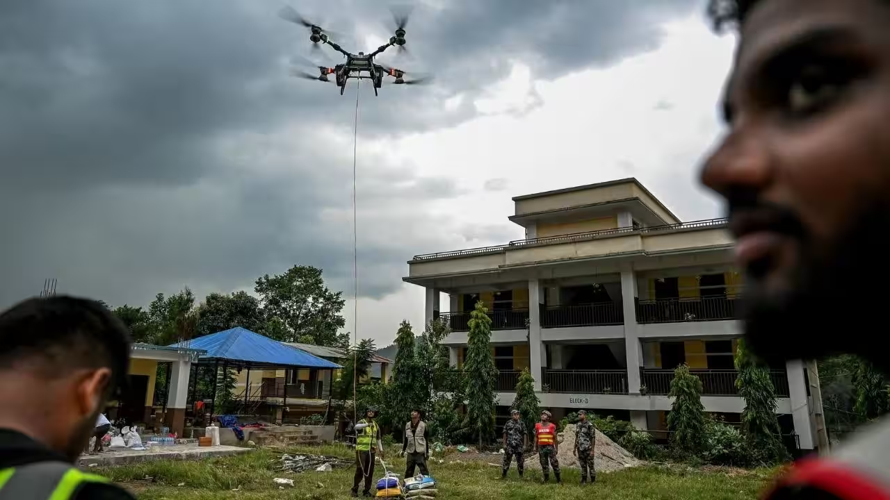
TRISHULI BAZAAR (NUWAKOT): As washed-out roads and bridges continue to hamper rescue and relief operations in Rasuwa and Nuwakot, an unusual technology network has sprung up around the disaster zone — drone pilots flying over devastated valleys on one end, and Nepalese abroad and global mapping volunteers scanning fresh satellite imagery from thousands of km away on the other.On the ground, drones are increasingly filling gaps created by the destruction — flying over debris fields and forests, using thermal cameras to look for stranded people and bodies, and carrying relief supplies to settlements unreachable by road.Among those operating them is Abhay Pokhrel, 23, who began flying drones as a hobby at 14 and later built a company, Garudex, around them. Working with AirLift Technology, his team has brought in a fleet ranging from thermal-surveillance machines to a heavy-lift drone capable of carrying up to 100kg. “We are using all of those right now,” Pokhrel told TOI on Monday.The cargo drones have been ferrying rice, instant noodles, clothing, sanitary pads and other relief supplies into cut-off areas. Light rain on Monday slowed the work of attaching packages to the drones with ropes and carabiners before they could be flown across the broken terrain. Pokhrel said his team transported around 500kg of relief supplies on Sunday alone. “Today we have a plan of doing the same or more,” he said.The thermal drones have another role. “We are doing surveillance of the dead bodies and people who are stranded around the forests,” Pokhrel said. “Our main focus currently is search and rescue and flood relief programmes with drones.”The machines are also being used to restore communications. Pokhrel said fibre-optic and network cables are being tied to drones and flown across rivers to hills on the opposite side, allowing damaged links to be reconnected where crossings have disappeared.“We are sending the fibre-optics cable and network cables through the river while tying it to the drone and taking it to another hill,” he said, adding that internet disruption extends beyond the immediate flood-hit region towards Gorkha.But the rapid proliferation of drones has also created risks in an airspace crowded with rescue helicopters. Pokhrel said authorities tightened flight rules after two drone pilots came dangerously close to a helicopter, disrupting operations.While Pokhrel and other pilots work above the valleys, another part of the technology effort is unfolding thousands of km away.Nepalese in the US, Europe, Australia, Gulf and elsewhere, alongside global mapping volunteers, are studying satellite imagery from home to help map the flood zone. Around 181 people were involved by Saturday in an emergency mapping exercise led by the Humanitarian OpenStreetMap Team, which is working with Nepal Prime Minister’s Office and local partners.“The main goal is to support rescue and recovery operations by providing accurate data to the teams working on the ground,” Kshitij Sharma, product owner at HOT, said.Volunteers are assigned small patches of satellite imagery and asked to trace buildings, roads and other visible features. A simple task can take 10 to 15 minutes, even for someone with no previous mapping experience. Experienced mappers then review and validate the work before it becomes part of an open-source map available to government agencies, humanitarian organisations, UN bodies and rapid-response teams.The exercise is particularly important where floodwaters and debris have changed the landscape so drastically that roads, buildings and familiar landmarks may no longer be recognisable. By comparing imagery from before and after the disaster, mappers can establish where a structure once stood and provide responders with its precise latitude and longitude.Catch the latest World News and Live updates. Download the TOI app.
Topics in this story
Gathered from external sources. Rights to this text belong to whoever originally published it.