In 2020, scientists poured dye into an Arkansas creek that ran into a dry stretch; they found the missing water resurfacing 2.9 miles farther downstream
Discover how USGS scientists used fluorescent dye to trace water flow in Arkansas's Big Creek, revealing connections between dry and flowing sections in the karst landscape. Explore the implications for water management and conservation.
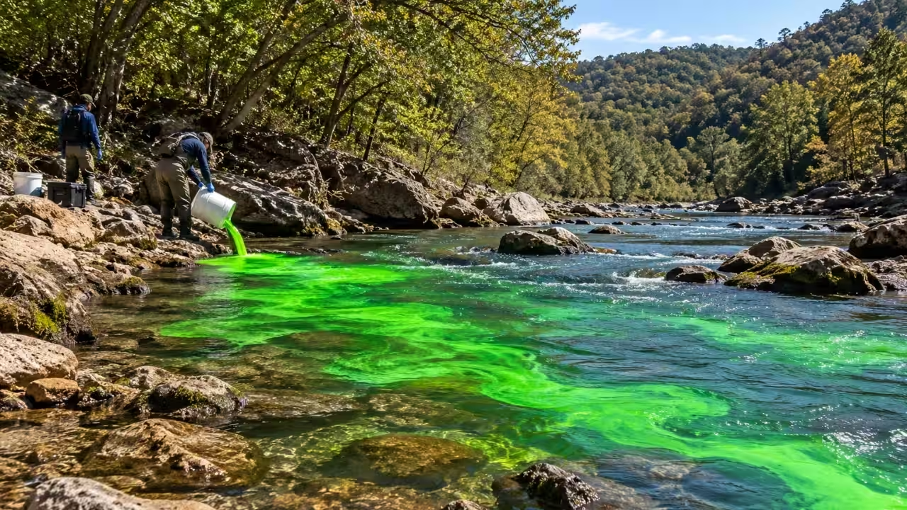
In October 2020, scientists investigating a stream in northwestern Arkansas used fluorescent dye to trace a hydrological connection beneath a seemingly dry stretch of creek. Following the introduction of the dye into a flowing section of the Left Fork of Big Creek, researchers noticed a point 2.9 miles downstream where surface flow resumed. The U.S. Geological Survey (USGS) spearheaded this field research as part of a targeted project on stream and groundwater interaction in Newton County, Arkansas, releasing the finalised data in January 2022. Moving into 2026, regional water management authorities actively utilise these resulting sub-surface karst maps to implement long-term watershed protection protocols and trace localised aquifer recharge rates.Tracing water through a dry stretchOn October 13 and 14, 2020, the investigation began when USGS researchers examined the Big Creek watershed to identify regions where streams lost or gained water. Primarily, the team focused on Big Creek and the Left Fork of Big Creek, while also examining the tributaries where road access permitted. The team took 13 stream-discharge measurements and recorded 48 observations of zero surface flow during the 28-hour investigation. These observations helped identify losing reaches, where water leaves a stream channel, and gaining reaches, where water enters it.After the initial examination, the team established 27 monitoring regions to detect fluorescent tracer dyes. On October 15, they introduced fluorescein into a flowing section of the Left Fork of Big Creek, upstream of a completely dry reach. Because karst systems feature permanently flooded phreatic conduits deep beneath unsaturated surface gravel packs, this underlying subterranean plumbing network remained active, providing the necessary hydrostatic mechanism to transport the tracer. The dye gave a way to test whether water from the injection area was connected to the locations further downstream. Scientists could then examine monitoring sites for proof of the tracer instead of relying only on the appearance of the creek.The dye was detected 2.9 miles downstream, at the next gaining reach, and at additional monitoring sites farther along the stream. This thus solidified a connection between the injection site and the downstream recovery site. Crucially, while the head-to-head volumetric data did not indicate a 100% quantitative recovery of all lost upstream water molecules, the clear detection of the chemical tracer confirmed a definitive subsurface pathway. Rather, the tracer showed that water from the flowing reach could travel through the local hydrological system and reach the downstream section.Why water disappears in the OzarksBig Creek lies in the Ozark region. Here, limestone formations have developed geological features known as karst, and over time, water dissolves soluble rock, creating fractures, openings and underground conduits. In these landscapes, water can seep out of a stream, move through the subsurface and emerge farther downstream. The USGS identifies the Mississippian-age Boone Formation, a limestone unit underlying substantial sections of Big Creek and the Left Fork, as a geological formation commonly affected by karst processes.Therefore, a dry stream channel does not really mean that all the water has vanished from the wider drainage system. Some water may enter underground pathways and return to the surface elsewhere. Depending on the local geology, it may also travel to a spring, cave or different drainage area. As these underground pathways are not always apparent from surface geography, researchers use fluorescent dye tracing to identify connections between losing and gaining reaches.What the findings mean for water managementIt is essential to understand the interaction between surface water and groundwater in karst areas since the transport of water through the subsurface may be unpredictable. According to the USGS, activities that take place on the surface may impact the quality and quantity of groundwater in such interconnected systems. Identifying where streams lose or regain water can help researchers and resource managers understand how water moves through a watershed and assess potential pathways through which contaminants could travel. Notably, the Big Creek study identified the hydrological connection and was not a test for pollutants.You use AI every day. Now get your AI Quotient. Take the AIQ test.
Topics in this story
Gathered from external sources. Rights to this text belong to whoever originally published it.