A Vermont dam built in the early 1900s to feed a private trout pond was breached in 2011; crews removed its remains in 2018, reopening 87 miles of stream
In 2018, crews removed the remnants of the Killooleet Dam, restoring fish passage along 87 miles of Vermont's Hancock Branch of the White River, allowing aquatic life to thrive once more.
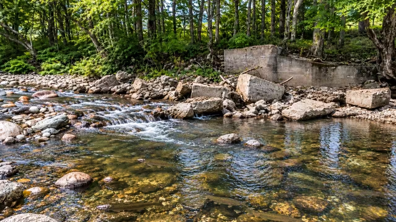
A dam constructed in Vermont in the early 1900s to provide water to a private trout fishing pond eventually turned into an obstruction to fish movement while disrupting the natural flow of a stream. The Killooleet Dam, located on the Hancock Branch of the White River near Camp Killooleet, was damaged by back-to-back floods before Tropical Storm Irene breached it in August 2011. This destroyed most of the structure, but concrete remnants stayed in the waterway, thus constricting the channel and preventing the stream from accessing the floodplain along its northern bank. After seven years, the White River Partnership (WRP) and its partners removed those remaining materials and carried out further channel improvements. The project reopened 87 miles of stream to fish passage.A dam built for a private trout pondThe Killooleet Dam was actually constructed in the early 1900s to feed a private trout fishing pond. As per reports, the estate was associated with a trout fishing club before becoming the site of a summer camp. During the major 1927 flood, the dam was reportedly damaged. It was, however, subsequently rebuilt when the camp was established. Camp Killooleet was established by Margaret Bartlett and Toni Taylor in 1927, with the Seeger family later taking ownership of the property.The structure suffered further damage during the flooding in 2008. Another major breach was caused by Tropical Storm Irene in August 2011. While the dam was no longer intact, its concrete remains continued to block part of the Hancock Branch. Thus, the problem was not just the presence of an obsolete dam, but the effects of the damaged structure that remained in the waterbody.The 2015 Upper and Middle White River Watershed Corridor Plan listed the removal of the destroyed dam as a high-priority project. Additionally, it identified that there was a separate requirement to improve the Hancock Branch’s connection with its floodplain. The plan noted that remnants of the old concrete structure created a channel constriction, while the affected area lacked some of the features needed for a more stable and diverse stream channel.Removing the concrete remnants in 2018The WRP received funding to develop priority projects identified in the corridor plan in 2017. Kate Seeger, who owned the Camp Killooleet property, expressed interest in working with the partnership on dam removal and floodplain restoration. The engineering design to help move the work forward was funded by her. The WRP subsequently joined hands with engineering firm Ripple Natural Resources and received funding from Vermont’s Ecosystem Restoration Program to implement the in-stream projects in 2018.Construction took place between August and September 2018. Harvey’s Excavating broke apart the remaining concrete dam structure and removed those pieces from the Hancock Branch in August. Following this, the contractor reportedly built three channel-spanning rock weirs along a 500-foot stretch of the stream. They used large stones and native rocks that were found at the site. While separate, they were complementary parts of the restoration: removing the concrete eliminated the old obstruction, while the rock structures helped reshape the channel.The rock weirs created pools and added roughness to the channel, improving the variety of in-stream habitat. They also raised the streambed elevation, which helped Hancock Branch reconnect with the adjacent floodplain along its northern bank.Reopening 87 miles to fish passageRemoving the Killooleet Dam remnants restored fish passage along 87 miles of stream, as noted by the WRP. The total comprises 36 miles upstream and 51 miles downstream of the former dam site. Rather than implying that the crews carried out construction across all 87 miles, the figure refers to the connected stream network made accessible to fish after the obstruction was eliminated.Connected waterways allow fish to move between various parts of a river system to access feeding areas, spawning grounds and other habitats. Structures like dams and other barriers can interrupt those movements. The US Fish and Wildlife Service describes fish passage as the ability of aquatic species to move freely through waterways during their life cycles. Removing such barriers can reconnect habitats that were previously separated.You use AI every day. Now get your AI Quotient. Take the AIQ test.
Topics in this story
Gathered from external sources. Rights to this text belong to whoever originally published it.