Hurricane Polo explodes into rare Category 5 monster after feasting on hot El Niño water
It became one of the fastest intensifying storms on record as El Niño fuels a hyperactive Pacific hurricane season.
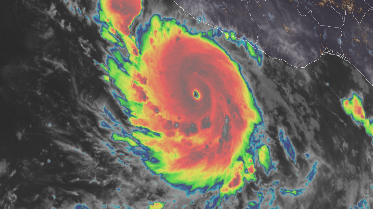
Hurricane Polo is still strengthening after undergoing extreme rapid intensification and becoming a rare Category 5 on Tuesday morning in the Pacific Ocean off the coast of Mexico. ⛈️ Check your local forecast and learn more about hurricanes in the CNN Weather app The 165 mph storm is feeding off of a favorable atmosphere and warmer water driven by the super El Niño, which is fueling a hyperactive hurricane season across the Pacific. More hurricanes are also rapidly intensifying as Earth and its oceans warm from fossil fuel pollution. Extreme rapid intensification is a wind increase of 58 mph or more in 24 hours. Polo met that criteria and then some, with a wind increase of 110 mph, going from a 50 mph tropical storm to a 160 mph Category 5 from Monday to Tuesday morning. This rate of rapid intensification is “truly remarkable,” the National Hurricane Center said Tuesday morning, and is among the fastest on record in the Eastern Pacific. Hurricane Patricia set the Eastern Pacific 24-hour intensification record in 2015 when its winds jumped 120 mph. Polo is comparable to 2023’s Hurricane Otis, which had a wind increase of 105 mph in 21 hours before slamming into and devastating Acapulco, Mexico. Polo was a few hundred miles south-southeast of Manzanillo, Mexico, on Tuesday. Its dangerous hurricane-force winds are forecast to remain offshore as it moves northwestward parallel to the Mexican coastline through the end of the week. The powerful hurricane is moving southeastward right now, but it’s expected to turn to the northwest on Tuesday night. Tropical storm alerts are in effect for Mexico’s southwestern coast since this area is expected to see tropical storm conditions by early Wednesday. Heavy rain is Polo’s most significant impact and it could cause life-threatening flooding and mudslides in this region. Rainfall totals in Guerrero and Michoacán states could reach 3 to 6 inches, with locally up to 8 inches in spots through Thursday. Coastal portions of Oaxaca, Colima and Jalisco states could receive 2 to 4 inches of rain. Read more on El Niño
Topics in this story
Gathered from external sources. Rights to this text belong to whoever originally published it.