Satellites map nearly 2,000 valleys and a buried mountain range beneath Greenland ice, revealing a vast subglacial network across the ice sheet
Beneath the Greenland Ice Sheet lies a vast, island-wide network of valleys.
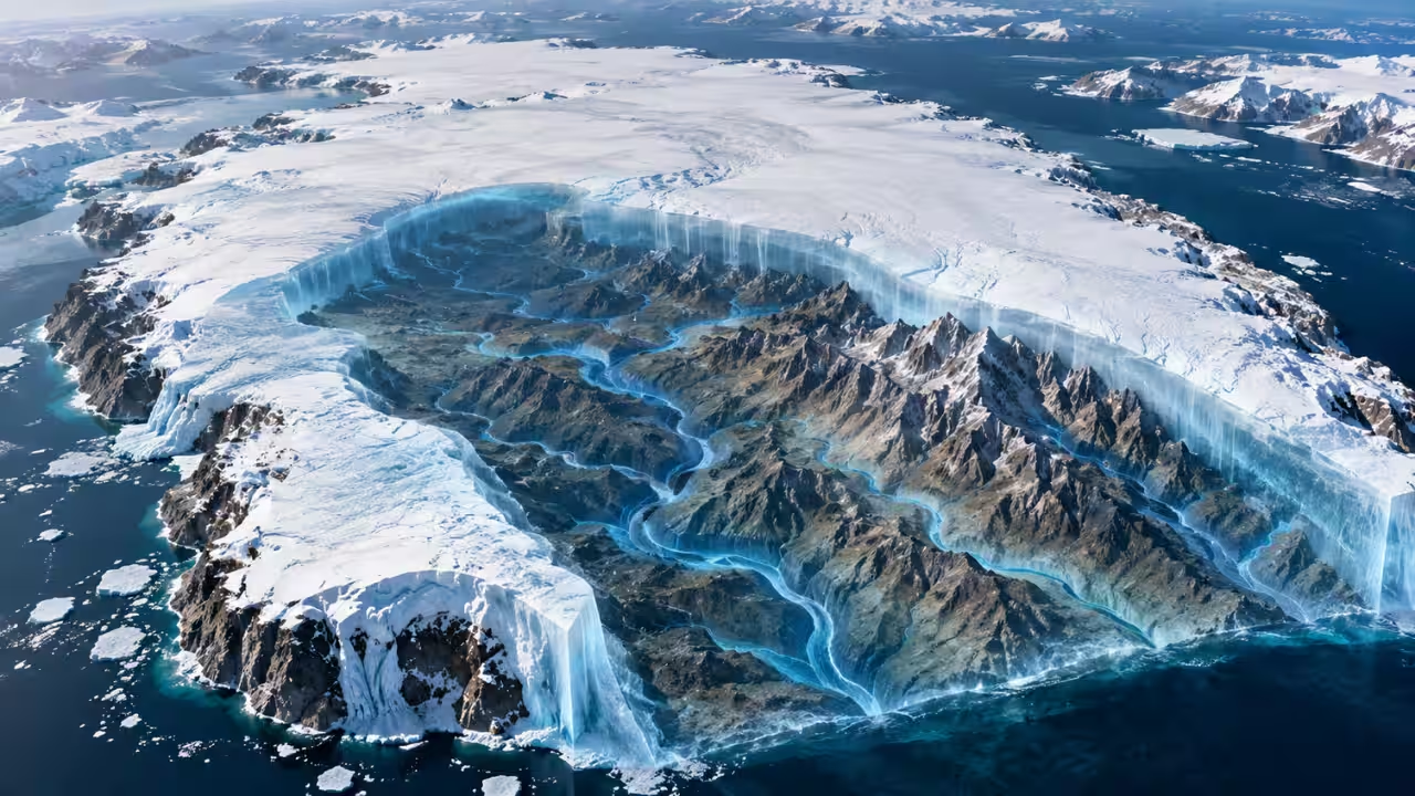
Beneath the Greenland Ice Sheet lies a vast, island-wide network of valleys. The team applied Ice Flow Perturbation Analysis to surface elevation and velocity observations and manually mapped 1,943 subglacial valleys, 34% of which are not present in BedMachine Greenland. According to a paper published in Geophysical Research Letters titled ‘A Vast Valley Network Beneath the Greenland Ice Sheet’, the network covers 74% of the ice sheet, compared with 39% in BedMachine. They also describe a subglacial mountain range south-east of the Northeast Greenland Ice Stream. In their view, the valleys' orientation and branching angles point to tectonic inheritance and a long-term groundwater influence.Why does BedMachine Greenland have gaps in subglacial valley mappingAccording to the study, mapping the bed along the margin of the Greenland Ice Sheet was transformed by reconciling measurements of ice thickness and surface velocity using the principle of mass conservation. The authors write that this method cannot be applied to the slower-flowing interior, where ice thickness observations are sparse. In the plain language summary, they say it leaves three-quarters of the ice sheet with poorly resolved bedrock topography. For the 150-metre-resolution BedMachine Greenland product, only 4.4% of ice-sheet grid cells include a radar observation.The interior and slower-flowing margins of that product are unrealistically smooth compared with the periphery, but pockmarked along survey lines by sparsely sampled valleys. The authors note that ice flow and subglacial water drainage tend to focus toward such valleys. Their alternative uses the fact that significant bumps and troughs in the bed can produce detectable variations on the surface. The method relies on bed-to-surface signal transfer theory and fine-resolution maps of surface elevation and velocity. It was developed by Ockenden and colleagues for Antarctica and is modified here for Greenland. According to the paper, the inputs are the GrIMP version 2 digital elevation model and the MEaSUREs Multi-year Greenland Ice Sheet Velocity Mosaic. Both are resampled onto the 150-metre BedMachine grid, and ice thickness comes from BedMachine Greenland version 6.How did researchers map 1,943 subglacial valleysThe researchers traced valley centrelines by hand at a scale of 1:750,000. They focused on valleys at least 10 kilometres long and 1 kilometre wide, the same criteria used by MacGregor and colleagues in 2024. The paper reports 1,943 mapped subglacial valleys. Of these, 34% are identified by the new method and are not present in BedMachine. The authors add that 52% of the valleys visible in BedMachine are extended farther by the new method. They state that many valleys resolved by mass conservation along the periphery extend much farther inland, sometimes hundreds of kilometres more than in BedMachine.Subglacial valleys confine the flow of nearly all of Greenland's 239 largest outlet glaciers, those with termini at least 1.5 kilometres wide. Most of these, about 70%, are extended farther upstream in the blended topography. According to the authors, most that are not extended lie in the south-east drainage basin and are relatively small, with discharge below 1 gigatonne per year. Based on mapped valley presence in a 10-kilometre grid, the paper reports that the areal extent of the valley network is nearly doubled in the blended topography, at 74% of the ice sheet, compared with 39% in BedMachine. The authors say this extent is limited mainly by where the blended map does not use the new method, mostly because of disrupted basal units in the northern ice sheet.What did researchers find beneath Greenland’s iceThe authors write that their analyses are consistent with the hypothesis that alpine-style subglacial geomorphology dominates the region south-east of the Northeast Greenland Ice Stream and next to the eastern highlands. BedMachine only hints at substantial relief there. The new method reveals a subglacial mountain range with an interconnected valley network, with increasingly greater relief to the east. The authors state that this network spans the transition from a likely frozen bed to the south to a likely thawed bed to the north, closer to the ice stream. They add that several deeply incised valleys slope approximately radially inland from this region. They describe these as preferential pathways for past subglacial or glaciofluvial erosion beneath what is now slow-moving and likely cold-based ice.In far southern Greenland, the paper says the new method also generates rough subglacial topography. There the ice is presumed to be warmer, and firn aquifers are more common, which limits the success of radar sounding and leaves BedMachine unnaturally smooth. The study reports that the subglacial southern highlands have similar relief to the coastal regions, and that this relief extends north into a valley network less clearly visible in either the surface or BedMachine. Automated mapping outlined 22 larger dendritic basins, each over 10,000 square kilometres. In southern Greenland, below 68°N, these basins coalesce around the southern highlands. Most basins farther north coalesce toward the eastern highlands. One of the two largest basins terminates at Sermeq Kujalleq (Jakobshavn Isbræ). The authors say their network differs from that of Cooper and colleagues in 2016, since the southern highlands feed Akuliarutsip Sermia, about 100 kilometres to its south-west, rather than Sermeq Kujalleq.How could 3,031 branching angles reveal Greenland’s past climateThe authors analysed valley orientation using Hough transforms across 75-kilometre squares. They report a typically bimodal distribution of azimuths by drainage basin. South-west to north-east is most common in the CW, NW, NE and CE basins. South-east to north-west is next most common, in the SW, NW and SE basins. These orientations bear no clear relation to modern ice-flow directions. The study links the dominant south-west to north-east azimuth to a left-lateral shear pattern proposed by Beh in 1975. That proposal came with a "Wegener Fault" in Nares Strait, which the paper says was discarded once geological and structural observations precluded the fault. The authors state that parts of Greenland's plate may still have experienced shear after the Late Cretaceous, and that valleys may later have exploited this tectonic inheritance. They add that GNSS stations record differences in horizontal plate motion directions that are presently unresolved. 3,031 branching angles in the valley network, with a distribution peaking between about 50 and 65 degrees. This range is diagnostic of climates where groundwater flow or soil erosion are non-negligible but smaller contributors to channel incision than precipitation or surface runoff. They write that it implies an aridity index of about 0.1 to 1 during valley incision. Slipperiness is set to a uniform value over most of the ice sheet, which the authors say is unlikely to be accurate. However, varying it only changes the amplitude of the perturbations, so they are confident in the locations of the valleys if not their absolute relief. Disrupted basal units in the north prevented use of the method in places, and the authors highlight these regions as possible targets for future airborne radar surveys.You use AI every day. Now get your AI Quotient. Take the AIQ test.
Topics in this story
Gathered from external sources. Rights to this text belong to whoever originally published it.