India's eye in the sky that never blinks: Inside GISAT-1A
News News: India achieved a significant space milestone after successfully launching GISAT-1A, also designated Earth Observation Satellite (EOS)-05, its advanced.
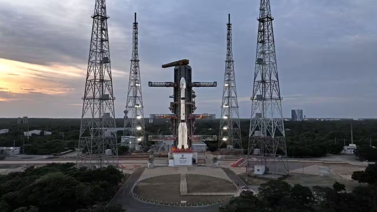
India achieved a significant space milestone after successfully launching GISAT-1A, also designated Earth Observation Satellite (EOS)-05, its advanced Geo-Imaging Satellite, aboard a Geosynchronous Satellite Launch Vehicle (GSLV) Mk II rocket from the Satish Dhawan Space Centre in Sriharikota.The launch marks a redemption story of sorts for Isro. The original GISAT-1, launched as EOS-03 in August 2021, failed to reach its intended orbit after the launch vehicle's cryogenic upper stage did not ignite as planned. This time around, the mission has gone off without a hitch, giving India its first operational satellite in this specialised category.What makes GISAT genuinely different from most of India's other Earth observation satellites is where it sits in space. Unlike conventional remote-sensing satellites that orbit in Low Earth Orbit (LEO), circling the planet multiple times a day and capturing images only when passing over a particular location, GISAT-1A has been placed in a geosynchronous orbit roughly 36,000 kilometres above the Indian subcontinent.A geosynchronous satellite matches Earth's rotational period, meaning it appears to stay put over the same general region of the planet continuously. This is fundamentally different from Low Earth Orbit satellites, which move quickly relative to the ground and only get periodic glimpses of any given area, or Sun-synchronous satellites, which pass over the same spot at the same local time each day but still only for a brief period.GISAT's persistent positioning allows it to keep a near-constant eye over the subcontinent, trading off some spatial resolution for continuous, real-time coverage. It represents a genuinely different design philosophy from Isro's typical Earth-imaging fleet.This persistent vantage point is what makes the satellite so useful for what is called remote sensing — the science of gathering information about the Earth's surface, atmosphere or oceans without any physical contact, typically using sensors that detect reflected or emitted electromagnetic radiation.Remote-sensing satellites act as very sophisticated cameras in the sky, capturing data across different wavelengths of light, including those invisible to the human eye, to reveal information that a regular photograph never could: soil moisture, vegetation health, water bodies, mineral deposits or the thermal signature of a wildfire.GISAT itself operates using multi-spectral and hyperspectral imaging, capturing data across a wide range of wavelength bands rather than just the visible spectrum. This allows scientists to distinguish between different types of land cover, crops, water quality or atmospheric conditions with far greater precision than a standard optical image would allow.The satellite is designed to deliver a sector-specific image of a selected area roughly every five minutes, and a complete image of the entire Indian landmass approximately every 30 minutes, at a spatial resolution in the tens of metres, while military satellites usually have a resolution of less than a metre.In practical terms, this gives Indian agencies something they have never really had before: an almost real-time, continuously updating picture of the country from space.EOS-05 plugs a long-standing gap in India's space-based Intelligence Surveillance and Reconnaissance grid, persistent surveillance. Most of our satellites sit in low earth orbit, which means excellent resolution but only fleeting passes over any given target. A geosynchronous platform like this flips that trade-off, you sacrifice some resolution, but you gain the ability to watch the same stretch of territory continuously, without interruption. On its own, that resolution limits its use for precision military tasking. But used alongside the LEO constellation, EOS-05 essentially becomes the overwatch layer, it flags where to look, and the higher-resolution LEO assets come in to confirm and detail. That combination, persistent wide-area watch plus high-resolution tasking, is really what a mature space-based surveillance architecture looks like.The applications this space-based asset unlocks are considerable. In disaster management, satellites like GISAT can track the formation and movement of cyclones, monitor flood extents as they develop, spot cloudbursts forming over vulnerable Himalayan regions and detect forest fires in their early stages — all crucial for issuing timely warnings and directing relief efforts more effectively.In agriculture, frequent imaging allows for crop health monitoring, yield estimation and drought assessment across growing seasons. The same data feeds into oceanography, glacier and snow-cover monitoring, mineral exploration, urban planning and, notably, security surveillance along India's borders and coastline — an application New Delhi has increasingly prioritised given the country's evolving security environment.India's journey into remote sensing did not begin with GISAT, of course. It stretches back to March 1988, when Isro launched IRS-1A, the country's first indigenous remote-sensing satellite, from the Soviet Baikonur Cosmodrome.That satellite, carrying relatively basic imaging sensors by today's standards, was designed to build India's foundational expertise in satellite imagery. It worked considerably better than expected, operating for four years against a planned mission life of three.It was followed over the subsequent decades by an expanding family of Indian Remote Sensing satellites, IRS-1B, IRS-1C and beyond, along with the RISAT series, which introduced radar imaging capable of seeing through cloud cover and darkness — something optical satellites simply cannot do.Altogether, India has launched around 40 dedicated remote-sensing and Earth observation satellites over the decades, though a significant number of the earlier ones have since completed their operational lives and been retired or deactivated.This steady accumulation of satellites and expertise matters a great deal for India's broader standing as a space power. Each new generation of Earth observation satellite, from the earliest IRS missions to today's GISAT, has progressively expanded what India can see, how quickly it can see it and how precisely it can interpret what it sees.This translates directly into greater self-reliance in critical areas like disaster response, food security planning, environmental monitoring and national security, reducing dependence on foreign satellite data for functions that are often too sensitive or too time-critical to outsource.GISAT-1A, sitting in its geostationary perch and watching over the subcontinent around the clock, effectively adds a persistent, always-on layer to this capability that India previously did not possess, complementing the periodic snapshots that its Low Earth Orbit satellites have long provided.With GISAT-1A now operational, India's space-based observation capability takes a genuine step forward — one that could prove its worth the very next time a cyclone forms in the Bay of Bengal, a forest catches fire in the Himalayan foothills or floodwaters begin rising somewhere across the country's vast and varied landscape.At the same time, India is building a robust military space architecture, expanding the largely civilian space programme with a sanctioned 52-satellite constellation under Space Based Surveillance Phase III, to be rolled out between 2025 and 2029.Notably, 31 of these satellites will be built by private industry, reflecting the growing role commercial players are being given in national security space programmes under the revised Space Policy 2026.The constellation aims to deliver persistent surveillance, secure communications and space situational awareness to monitor India's borders and maritime approaches. It is anchored in the Joint Military Space Doctrine announced at the 2025 Combined Commanders' Conference in Kolkata, which formally recognised space as a contested warfighting domain.Instead of relying on a handful of large satellites, India's upcoming space architecture uses a proliferated Low Earth Orbit design. The country will deploy dozens of smaller, agile satellites to reduce vulnerability to anti-satellite weapons and ensure redundancy.These satellites will carry hybrid payloads combining synthetic aperture radar and high-resolution optical sensors for round-the-clock, all-weather monitoring. Besides these, the satellites will also provide secure communication links.India is simultaneously developing counter-space capabilities, including electronic warfare and kinetic options. This includes the anti-satellite weapon system demonstrated by the country.
Topics in this story
Gathered from external sources. Rights to this text belong to whoever originally published it.