This year’s El Niño looks a lot like 1997. What happened then?
Columbia University climate scientist Azhar Ehsan said in a September media briefing that this year’s atmospheric evolution looks similar to that of 1997, when one of the strongest-ever El Niños formed.
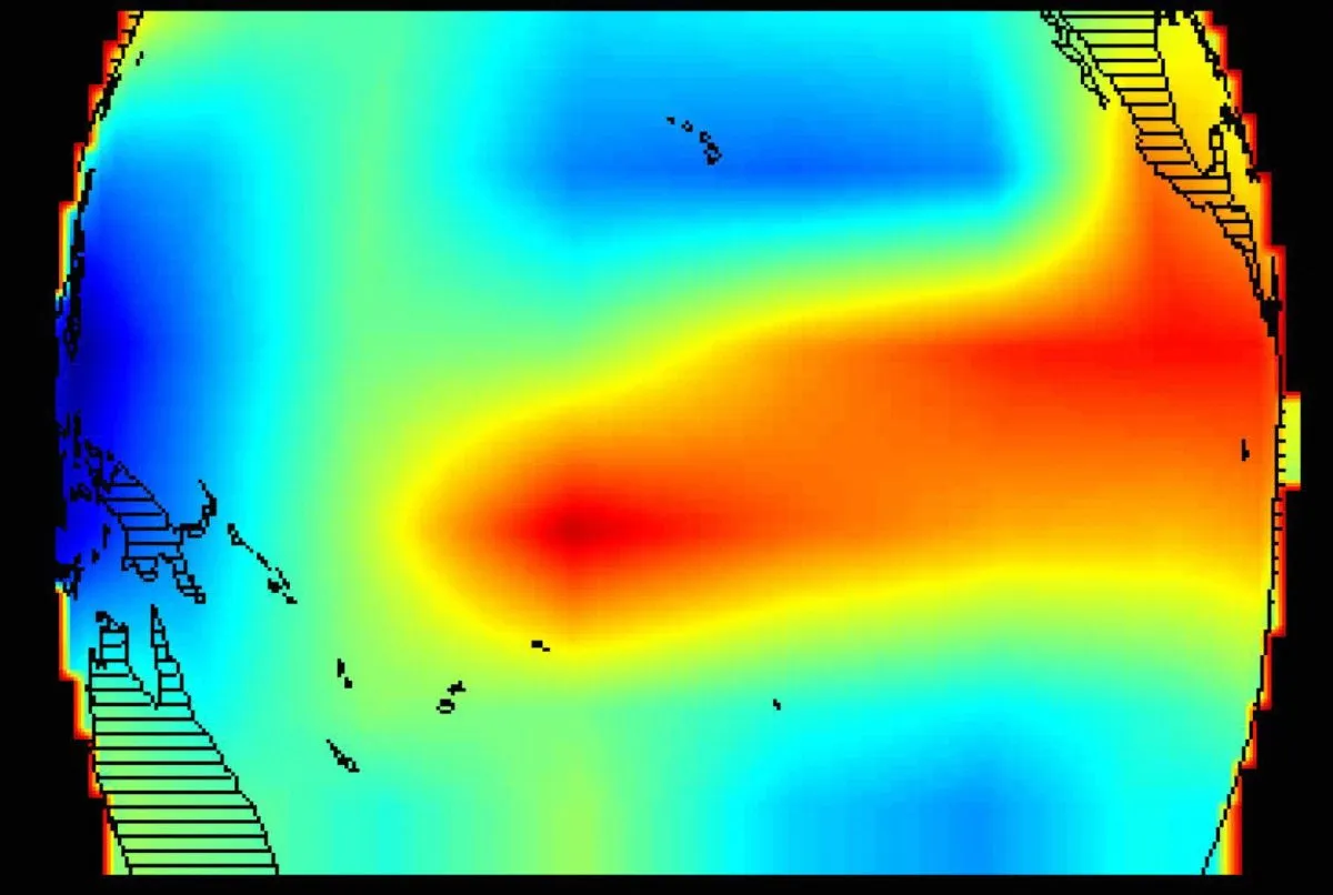
(NEXSTAR) – This year’s El Niño is shaping up to be the strongest in recorded history . That makes it tough to compare to prior years, but if we wanted to look to history for answers, we should go back in time to 30 years ago.
Looking at trade wind patterns, Columbia University climate scientist Azhar Ehsan said in a September media briefing that this year’s atmospheric evolution looks similar to that of 1997, when one of the strongest-ever El Niños formed.
That winter was characterized by broken records and “unusual extremes,” climate researchers said in an April 1998 National Climatic Data Center report . It was the country’s second-warmest and seventh-wettest winter since 1895.
The super-strong El Niño contributed to chaotic weather from coast-to-coast. While the Northeast was hit with ice storms, the Southeast and California were drenched with flooding rain. Deadly tornadoes also tore across Florida.
Typically during an El Niño winter, the southern half-to-third of the country is wetter than normal, while the northern states are warmer and drier.
In the winter of 1997-1998, the weather was warm and wet for much of the country. California had its wettest winter on record, as did North Dakota. Several other states had their second-wettest winters: Florida, Maryland, Nevada, Rhode Island and Virginia.
Florida was drenched in December, with Tampa receiving more than 15 inches of rain. In January, New Orleans received more than 19 inches, Mobile, Alabama, had 17 inches, and Asheville, North Carolina, had 10.
A bad storm in early January caused flooding, ice storms and tornadoes across the eastern half of North America. The death toll was 56 across the U.S. and Canada. Hundreds of homes were destroyed, and millions were left without power.
The following month, California and the Southwest were hit with “four weeks of nearly continuous storminess,” which triggered mudslides and widespread flooding.
Even places that didn’t get dumped on hardly saw the sun. Des Moines, Iowa, had an 11-day cloud streak in December, the report said, and the normally sunny Albuquerque, New Mexico, saw no sun in the days leading up to Christmas.
People accustomed to freezing winters found themselves with unseasonably warm weather.
“The warmest February on record took place in much of the upper midwest and parts of the east including Minnesota, Wisconsin, Illinois, Michigan, Ohio, Pennsylvania, and Connecticut,” the report reads.
For the first time ever, cities in northern Montana recorded no temperatures below freezing in December 1997. By the end of February, Lake Erie at Buffalo was still unfrozen, with water temperature at 36 degrees.
One upside of the weird weather was that that heating costs were 10% lower nationwide when compared to a normal year. That sort of savings might be welcome in 2026, as energy costs have soared .
Models indicate this year’s El Niño will be even stronger than the 1997-1998 pattern.
Expected to be super-strong , the climate phenomenon is likely to fuel drought in some areas, flooding in others, and as many as 451,000 weather-related deaths globally .
With a strong or “super” El Niño, we’re more likely to see the typical pattern of warm and dry weather up north, and cold and wet weather down south. Where the dividing line falls varies year to year, depending on the position of the jet stream.
This year’s El Niño has been gaining strength since it first arrived on the scene over the summer. National forecasters say there is a 75% chance we’ll see “a historic event that would exceed the strength of previous El Niño events dating back to 1950.”
While El Niño doesn’t usually reach its peak strength until the winter months, there are already signs it has been influencing the weather in late summer and early fall. It’s one of the reasons we’ve seen such a quiet Atlantic hurricane season, but an active storm season in the Pacific.
The temperature and precipitation outlooks for the rest of the year are also in line with a classic El Niño pattern.
Topics in this story
Gathered from external sources. Rights to this text belong to whoever originally published it.