In 2024, USGS mapped Tennessee’s hidden groundwater using 25 dye injections; routes reached nearly 8 miles, defining recharge areas for six springs spanning up to 65 sq mi
The U.S. Geological Survey conducted dye tests to trace Tennessee's groundwater, unveiling nearly 8-mile underground routes and identifying vital recharge areas for six springs, crucial for local ecosystems and drinking water sources.
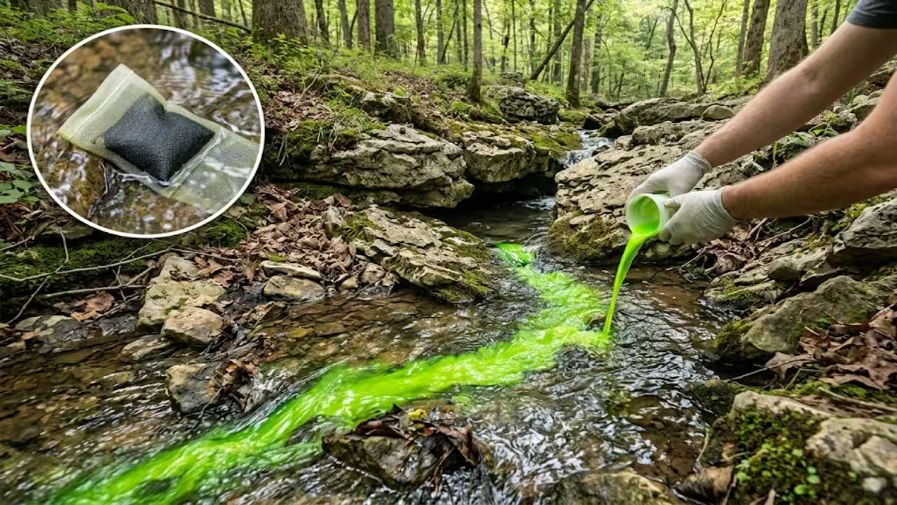
Some streams in Tennessee disappear into openings in limestone, travel through underground passages and emerge at springs miles away. Water is abundant here, but it is also fragile in this karst terrain. Because surface water can enter underground channels directly, pollutants entering a sinking stream may reach springs that support communities and sensitive species. The USGS report describes these connected surface-water and groundwater systems as vulnerable to contamination.Because the routes lie underground, they cannot be mapped from the surface alone. The U.S. Geological Survey (USGS), in cooperation with the U.S. Fish and Wildlife Service and the Tennessee Department of Environment and Conservation, used fluorescent dye to trace water moving through sinking streams and cave systems. The researchers conducted 25 dye injections in the Little Sequatchie River and Pryor Cove watersheds in southern Tennessee between January 2022 and March 2023. A USGS assessment published in 2024 documented groundwater routes approaching 8 miles and delineated recharge areas for six major springs, ranging from about 7.3 to 65.2 square miles.Why the springs matterThe two valleys lie on the eastern side of the Cumberland Plateau, an area known for its caverns and subterranean wildlife. Many streams sink where the Pennington Formation meets the underlying Bangor Limestone, leaving long dry stretches of streambed that carry water mainly during floods. Farther down the valleys, springs bring some of that water back to the surface. The USGS report documents 103 caves in the study area, including an underwater cave at Blue Spring that is 2.46 miles long.Some of these springs are lifelines. Sequatchie Cave provides habitat for the Sequatchie caddisfly and the federally endangered royal marstonia, while Blue Spring supplies drinking water to the Town of Jasper. Springs and spring-fed streams also provide water for agriculture and nearby settlements. Because surface water can enter underground passages and re-emerge at springs, pollution upstream can threaten the wildlife and communities that depend on these water sources.How the dye tracing workedThe researchers injected four nontoxic fluorescent dyes into sinking streams, known as swallets, and cave streams. Each dye fluoresces at a distinct wavelength, allowing laboratory analysis to distinguish it from the others. The amount used ranged from half a pound to four pounds per injection, depending on the site. The USGS report details the injection locations and quantities. Researchers then waited for the dye to reappear at monitored springs and streams.To collect the dye, researchers placed sachets containing activated coconut charcoal inside milk-filter socks at 39 springs, cave streams and surface-stream sites. The charcoal absorbed dye moving through the water. Researchers collected the packets at intervals ranging from daily to weekly and sent them to the Crawford Hydrology Laboratory in Bowling Green, Kentucky, for fluorescence analysis. A trace was counted as positive when dye concentrations exceeded ten times the background fluorescence recorded at that site, following the USGS report’s methodology.Two injections in March 2023 presented a practical challenge because the streambeds were completely dry. A tanker truck supplied by the Jasper Volunteer Fire Department flushed each half-pound dye injection with about 3,500 gallons of fresh water, allowing the tracer to enter the underground system. The USGS report also recounts a 2017 demonstration by volunteers in a cave biology course. They expected the dye to reach Keira Spring, about half a mile from the injection point, but it appeared at Sequatchie Cave nearly two miles to the south. The result illustrated how far underground water can travel.What the dye revealedThe longest trace ran about 7.7 miles, or 12.4 kilometres, from a sinkpoint on the Little Sequatchie River to the spring group known locally as the Boils. The dye remained underground along the route, making it one of the longest documented traces in Tennessee. Another trace, from Pocket Creek to Dancing Fern Cave, covered 6.74 miles, with the dye arriving in about 48.8 hours. The fastest trace was a separate test in December 2022: dye emerged at Niagara Spring, downstream from the Boils, in less than 30 minutes, at an estimated average velocity of about 1,400 feet per hour. These measurements are documented in the USGS report.The experiments delineated six recharge areas: the land from which rainwater and streams feed a particular spring. Some of these areas overlap. Sequatchie Cave and Keira Spring share about 5.8 square miles in Dixon Cove, and the dye results indicate that Keira acts as an overflow outlet for the cave system. This may help explain why Keira dries up during droughts while the cave continues to flow. The USGS report maps the recharge areas and their shared boundaries.Why the map mattersForest covers more than 77% of each recharge area, but the USGS assessment also identifies potential threats to groundwater quality, including development, logging, rock mining, acid mine drainage, pipelines, roadside dumps and off-road vehicle use. Part of the Town of Jasper lies within the Blue Spring recharge area, so nearby activities could affect the spring that supplies its drinking water.The Little Sequatchie work is part of a broader initiative. A fluorescence tracing initiative by the USGS and TDEC is investigating karst springs throughout Tennessee, particularly where the water may be used for drinking. In the 2024 water year alone, tracing has occurred near the municipalities of Caryville, Lafayette, Morristown, Mount Pleasant and Vanleer, all of which depend on karst groundwater.The maps help land managers identify which areas drain toward a spring and help planners assess where a spill or construction project could affect water supplies or sensitive species. The USGS report cautions that rainfall patterns and changing groundwater or stream levels can shift recharge-area boundaries. The mapped lines should therefore be treated as estimates rather than fixed borders.
Topics in this story
Gathered from external sources. Rights to this text belong to whoever originally published it.