In 2021, USGS scientists injected green fluorescent dye into Colorado’s Slate River to pinpoint where groundwater was discharging into it
Discover how USGS researchers are using green fluorescent dye to trace groundwater entering the Slate River in Colorado, providing insights into river health and water resource management amidst climate change.
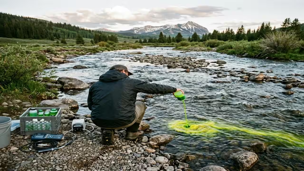
From a bridge, rivers appear straightforward. Water flows continuously down from the mountains. A significant portion of the water in many streams has spent time below, seeping in through the bed and banks long after the rain or snow that fed it has passed. This is more difficult to observe. That unseen factor can determine how well a river endures dry times in alpine valleys like the one surrounding Crested Butte.Scientists at the US Geological Survey have been trying to work out where it enters, and it’s easy to imagine their methodology. They introduce a nontoxic green fluorescent dye into the Slate River and follow it downstream. The 2021 dye injection formed part of a broader USGS effort to identify groundwater inflows along the Slate River between Oh Be Joyful Campground and Crested Butte. The wider research program continues to investigate groundwater discharge and its role in sustaining streamflow under changing climate conditionsHow the dye worksThe dye is fluorescein, a bright green and nontoxic tracer. According to the alert, it was released as a continuous slow drip for roughly 4 to 10 hours at a spot near the campground, with injection between 3 and 7 in the evening. Hydrologists then monitored it at downstream locations through the night. The late timing was deliberate. It kept the river from turning green during busy daytime hours, and the colour was expected to linger as a light yellow to green tint for 12 to 24 hours. Little or no change was expected south of the Peanut Lake area.Fluorescein is useful because it dissolves readily in cold water, can be detected at very low concentrations and tends not to adhere strongly to soil and rock. Research on groundwater tracing in Yellowstone describes fluorescein as detectable at very low concentrations over long distances, low in toxicity, soluble in cold water and relatively unlikely to adhere to soil and rock. The technique itself is old, and USGS publications on using fluorescein to study underground water go back to 1906.Finding the seepsThe logic is dilution. Dye is added to the river at a known rate, so its concentration downstream should stay steady if nothing else enters the channel. When clean groundwater seeps in, it dilutes the dye, and the concentration falls. Sampling at several points along the river shows where the water enters and roughly how much arrives. The Slate River injection used the same dilution principle to estimate how much groundwater flows into the river.The same approach can reveal surprising speeds underground. In the Yellowstone work, fluorescein released into streams that disappear into the ground on Sylvan Pass reached Mammoth Crystal Springs at apparent rates of at least 8,000 feet a day, or about 2.4 kilometres. That was a clue to how quickly water moves through the rock beneath.The Slate River work also involves partners. The project also involves the U.S. Bureau of Land Management, the Crested Butte Land Trust and the Rocky Mountain Biological Laboratory, bringing together local knowledge and hydrological research.Why this mattersTracing groundwater is important because underground inflows can help sustain streams after snowmelt declines. Streams in snow-fed mountain valleys carry large amounts of meltwater during spring and early summer, while groundwater can continue contributing to flow during drier periods. Knowing where groundwater enters a river and how much water arrives helps land managers and communities assess the reliability of streamflow. The Colorado Water Science Center also uses thermal infrared cameras to identify likely groundwater-discharge zones through temperature differences between groundwater and stream water. Thermal imaging helps locate possible inflow areas, while dye-tracing measurements can estimate how much groundwater enters the river.The Slate River isn’t one-off, either. Similar dye-tracing has been disclosed by the USGS in Lake Fork Creek in Leadville and the Fraser River between Fraser and Winter Park, so the practice is becoming a routine aspect of how the agency analyses Colorado’s water. The conclusion is simple. Hydrologists track a faint, innocuous green hue through the night, turning an undetectable flow into a measurement. The colour fades in a day, but the map of where groundwater supplies the Slate River can guide decisions about the river for years.
Topics in this story
Gathered from external sources. Rights to this text belong to whoever originally published it.