An Ohio wetland was taken over by invasive reeds in 2000; by 2022, cattails and other wetland plants had become dominant
A wetland in the western Lake Erie region of Ohio offers researchers a long-term record of vegetation changes following restoration.
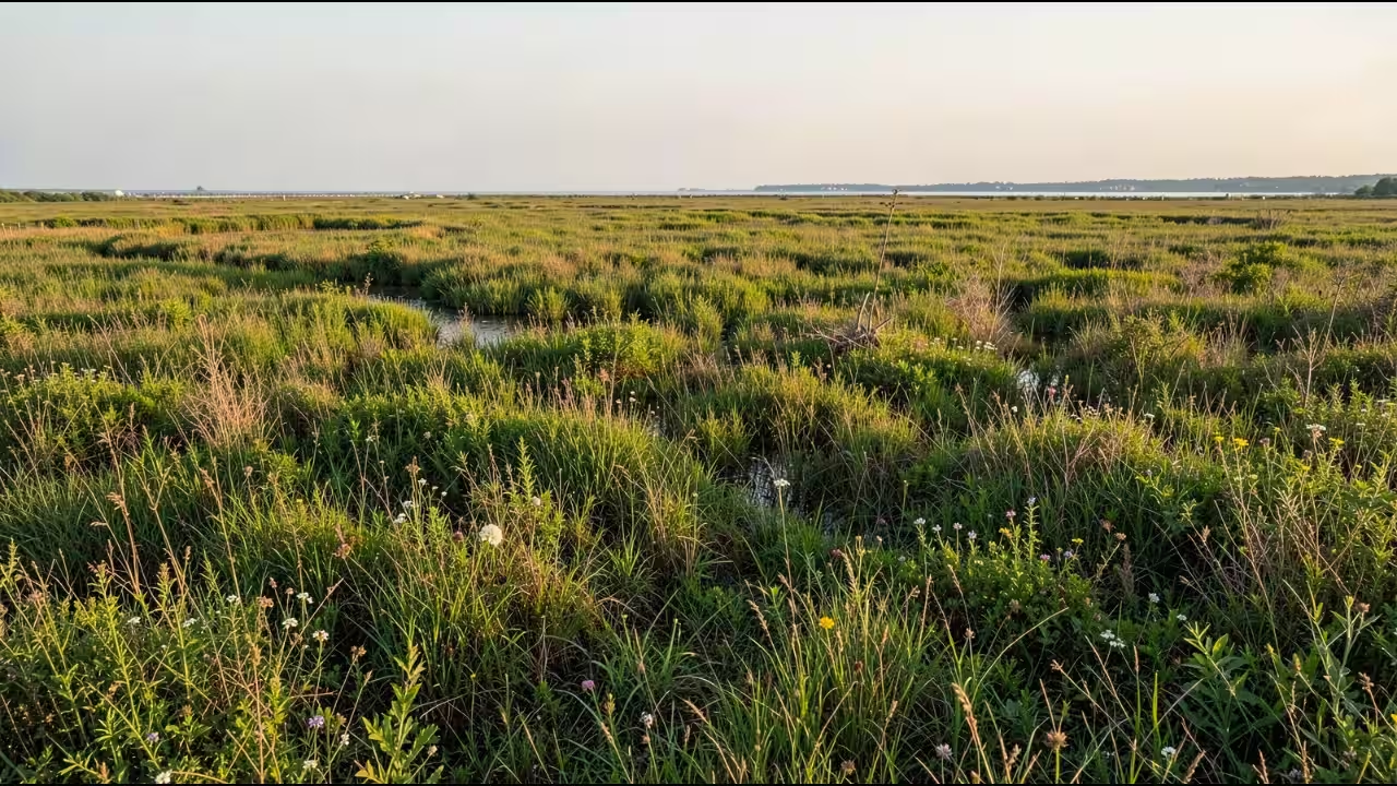
A wetland in the western Lake Erie region of Ohio offers researchers a long-term record of vegetation changes following restoration. In a study titled The Metzger marsh restoration—a vegetation-centric look after 27 years published in the Journal of Great Lakes Research in its April 2024 issue, Douglas A. Wilcox, Kurt P. Kowalski and Alexandra A. Bozimowski examined Metzger Marsh using vegetation records spanning 1994 to 2022. The research traces changes after a dike was built in 1995 to replace a protective barrier beach that had eroded. Water levels were lowered the following year, and the vegetation changed over the years that followed. By 2000, invasive common reed had become dominant, while later management measures reduced its extent. By 2022, cattails and other wetland plants were dominant. The findings document the changing plant communities recorded during the restoration project.Metzger Marsh restoration: why the dike was builtMetzger Marsh is a coastal wetland in the western Lake Erie region of Ohio, near the Ottawa National Wildlife Refuge and the Metzger Marsh State Wildlife Area. The restoration project was designed to recover a 300-hectare wetland that had deteriorated following the loss of its protective barrier beach.In 1995, a dike was constructed to replace the function of the eroded barrier. Unlike a structure that would completely separate the marsh from the lake, it incorporated a water-control mechanism to allow managers to regulate the connection between the two. A passage for fish was incorporated into the structure, with the design intended to limit the movement of large common carp into the marsh. The researchers examined vegetation before, during and after construction. Their analysis used colour-infrared aerial photographs from 1994 to 2010, together with imagery from 2022. They also carried out quantitative sampling of major vegetation types. These records provided a basis for comparing the plant communities at different stages of the restoration.From mudflat vegetation to invasive common reedThe first recorded changes followed a reduction in water levels in 1996. According to the researchers, the drawdown prompted plants to emerge from the soil’s seed bank, including species associated with exposed mudflats. Tree seedlings also appeared. More than half of the marsh was vegetated during this early period and in subsequent years. The study records the water-control structure opening in 1998. By 2000, invasive Phragmites australis, or common reed, had become the marsh’s dominant plant. Its spread marked a substantial change in the vegetation recorded during the project.The study also records that herbicide use and flooding eliminated most of the trees. Management measures subsequently reduced the area occupied by Phragmites. The sequence matters because the vegetation observed during the first years after the dike was built differed from that found later. Mudflat plants and tree seedlings appeared after the drawdown, followed by the spread of invasive common reed. Subsequent management was accompanied by a reduction in the reed’s extent.Cattails and other wetland plants dominate by 2022By 2022, Typha species, commonly called cattails, had become dominant alongside broadleaf arrowhead (Sagittaria latifolia) and softstem bulrush (Schoenoplectus tabernaemontani). These plants formed the dominant vegetation recorded at the end of the study period, in contrast with the prominence of invasive Phragmites around 2000.The authors concluded that the restoration project had increased habitat value for fish and wildlife. They also identified the project as a useful reference for future restoration work involving land managed by different agencies. The research highlights the practical importance of examining ecological changes across many years when evaluating a wetland restoration project.What the long-term record showsThe study draws on records from 1994 to 2022, an elapsed span of 28 years. Its title describes the restoration as a 27-year project, but the available publication details do not specify how that period was calculated. The findings are best understood through the dated observations and the vegetation changes documented over the study period. Rather than establishing a universal pattern for restored wetlands, the Metzger Marsh research documents the course of one project. It records the initial response to lowered water levels, the later dominance of invasive common reed, subsequent management and the prevalence of cattails and other wetland plants by 2022. Together, these observations provide a long-term basis for understanding vegetation change at the site and evaluating restoration management.You use AI every day. Now get your AI Quotient. Take the AIQ test.
Topics in this story
Gathered from external sources. Rights to this text belong to whoever originally published it.