An Australian caver spotted an 11-km scar while searching Google Earth; scientists later found a tornado had torn through the Nullarbor
Rest of World News: An unusual line across the otherwise open landscape of Australia’s Nullarbor Plain might have gone unnoticed if not for a caver looking at satellite i.
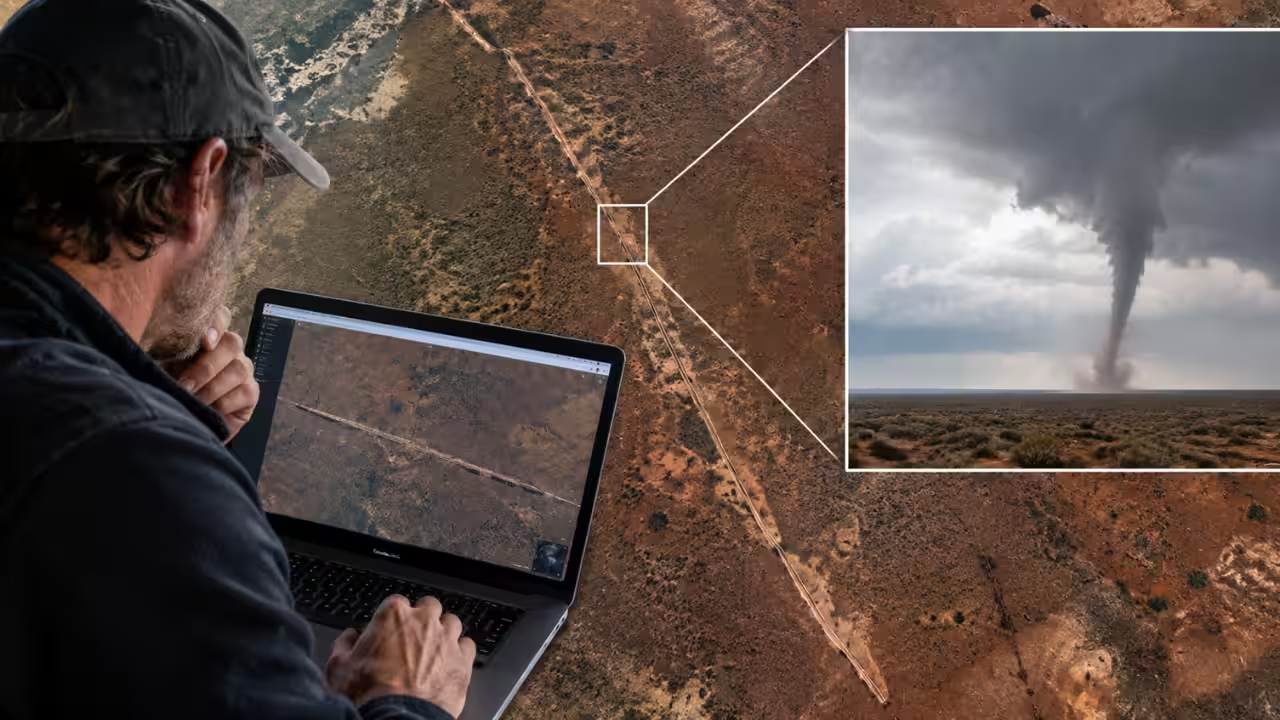
An unusual line across the otherwise open landscape of Australia’s Nullarbor Plain might have gone unnoticed if not for a caver looking at satellite imagery. While browsing Google Earth, he came across a long, narrow disturbance cutting through the remote terrain. There were no buildings nearby, no obvious roads and no reports of a storm that could explain it. From above, the feature looked remarkably clear. It stretched for about 11 kilometres, crossing the border between Western Australia and South Australia. Months later, scientists examining the site and comparing older satellite images reached an explanation.An Australian caver spotted the mysterious scar on Google EarthSatellite images showed a scar between roughly 160 and 250 metres across, extending for kilometres through the dry landscape. Its position also helped explain why the discovery took time. The scar is about 22 kilometres north of the Trans-Australian Railway and roughly 90 kilometres east-northeast of Forrest, a former railway settlement. There is very little regular human activity across the surrounding country, meaning a weather event could pass through without anyone nearby to report it.The researcher used satellite imagery from different dates to establish when the change had appeared. According to the study published in the Journal of Southern Hemisphere Earth Systems Science, titled ‘Tornado scar on the Nullarbor Plain, Australia’, their comparison placed the formation of the scar between 16 and 18 November 2022. Around the same period, several circular blue areas could be seen in the imagery. These were interpreted as temporary pools produced by heavy rainfall.Physical evidence linked the scar to a powerful stormThe scar itself was only part of the evidence. Looking at images taken before and after the suspected event allowed the team to determine that the feature had not always been present. Weather information from the same period pointed to a storm system moving across the region. The rainfall and cloud cover provided a plausible setting for the ground disturbance, but they did not by themselves establish that a tornado had passed over the Nullarbor.When researcher eventually examined the area, they found curved, cycloidal traces running along sections of the scar. Such marks are associated with the movement of debris and vegetation within tornado damage paths. Their presence gave the otherwise puzzling satellite feature a much more specific explanation.What the unusual marks revealedThe shape of the disturbance suggested that the storm had not simply produced widespread flooding or surface runoff. Cycloidal marks were visible in parts of the affected area, while the scar showed erosion and the removal of soil and pieces of vegetation.According to ABC News, Dr John Allen, a meteorologist at Central Michigan University who was not involved in the research, pointed, "Cycloidal marks are quite evident, and these are seen in US tornado damage paths.”"The appearance of the path without substantive evidence of flooding as an alternative cause would further lend support to this argument."The study estimated that the tornado may have reached F2 to F3 intensity, with estimated wind speeds of more than 200 km/h. Its track indicated movement from west to east, with clockwise rotation. The researcher estimated that it may have remained on the ground for between seven and 13 minutes.Australia’s remote Nullarbor left the tornado unseenThe lack of eyewitness accounts is less surprising when the location is considered. The Nullarbor Plain contains enormous areas of sparsely populated, largely flat terrain. The tornado did not cross a town or strike major infrastructure, so there was little chance of someone seeing it directly or reporting damage immediately afterwards.The researcher noted that only three tornadoes had previously been recorded in the region. All three occurred during November, the same month as the event identified from the satellite imagery.That does not establish a broader seasonal pattern on its own, particularly in an area where observations are limited. It does, however, provide an interesting point of comparison for a region with relatively little historical tornado documentation.The scar remained visible long after the stormThe dry conditions of the Nullarbor also helped preserve the evidence. The disturbance could still be seen around 18 months after the suspected tornado. In a landscape where vegetation recovery is slow, the damaged strip did not quickly disappear beneath new growth.That persistence gave scientists an opportunity that would not necessarily exist in a wetter or more heavily vegetated environment. A storm that had passed without witnesses had effectively left a record of its route on the ground.Matej Lipar, a physical geographer from the Slovenian Academy of Sciences and Arts and a study author, described the feature as a kind of surface signature left behind by the storm. With comparatively little vegetation covering the ground, the path remained visible long after the weather event itself had ended.Catch the latest World News and Live updates. Download the TOI app.
Topics in this story
Gathered from external sources. Rights to this text belong to whoever originally published it.