In 1996, USGS released an 8-day Glen Canyon flood at 1,275 cubic metres per second to track sediment; 120 cross sections measured how the flood changed the Colorado River channel
US News: In 1996, USGS conducted a controlled flood to study sediment dynamics and restore natural habitat in the Colorado River. Discover the results and implications of this groundbreaking experiment.
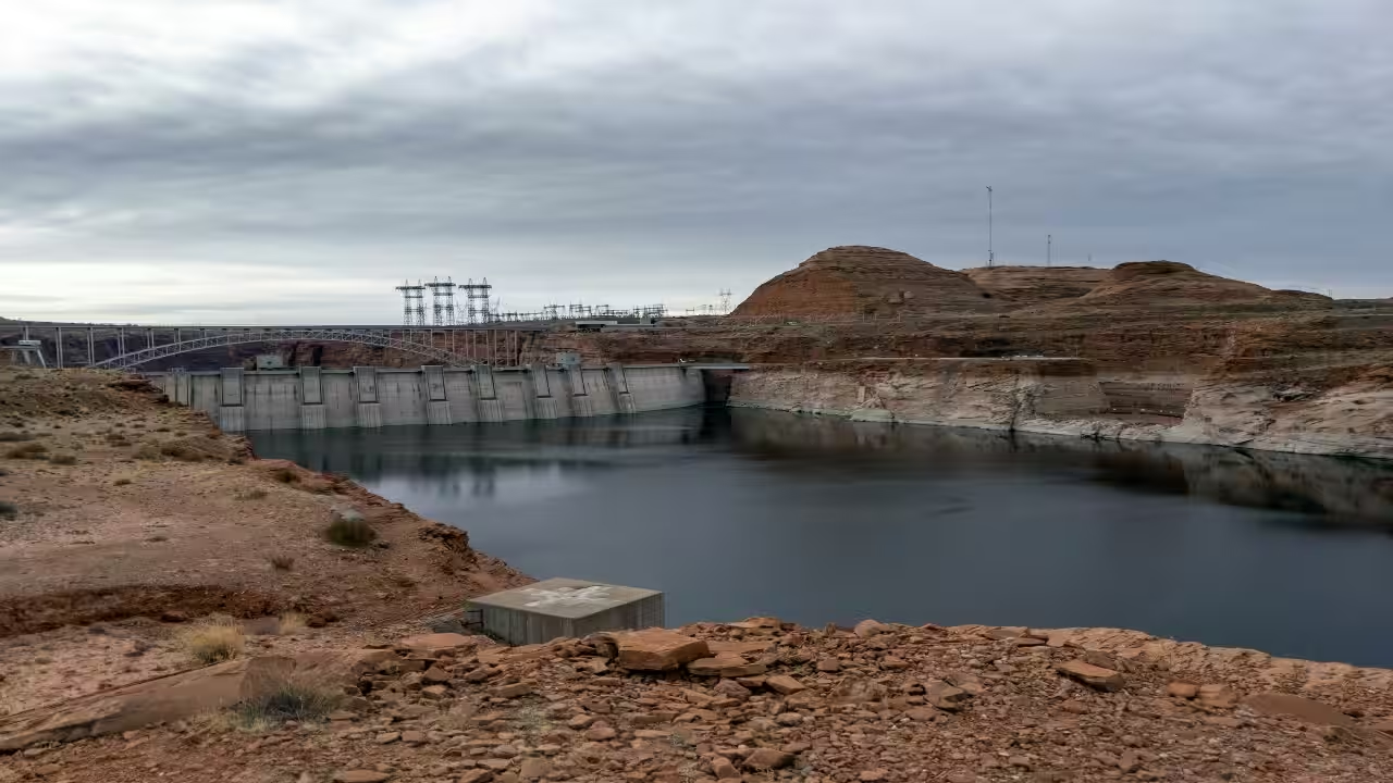
In March and April 1996, a planned high-flow experiment at Glen Canyon Dam released water at a rate of 1,275 cubic metres per second for eight days as scientists studied how the surge would affect the Colorado River downstream. The purpose was not to generate power or cope with an unexpected surge. It was to test whether an artificial flood could repair some of the damage the dam itself had caused to the river downstream, particularly the sandbars and beaches that had been quietly disappearing for more than thirty years.How Glen Canyon Dam changed the Colorado RiverGlen Canyon Dam was completed in 1963, and it changed the Colorado River almost overnight. Before the dam, spring snowmelt sent huge pulses of sediment-laden water crashing through Grand Canyon every year, scouring the channel and depositing fresh sand along the banks. Once the dam went up, that rhythm stopped. Lake Powell, the reservoir behind it, trapped nearly all the incoming sand, and the steadier, regulated releases from the dam no longer carried enough sediment to replenish the beaches. Over time, campsites and backwater habitats that native fish and plants depended on began to erode. Researchers had a theory that a short, powerful flood, timed correctly, might scoop sand off the riverbed and push it back onto the banks. Testing that theory meant watching the river extremely closely while the flood happened.Tracking sand at 120 points along the riverNearly a hundred geomorphologists and ecologists spread out along a 385-kilometre stretch of the Colorado, from Glen Canyon through Marble Canyon and into the Grand Canyon, to record what happened as the water rose. The US Geological Survey collected data at five streamflow gauging stations on the main river and four more on tributaries during the controlled flood, while river stage readings came from an additional 29 locations. To measure how much sand was actually shifting, crews documented changes in the channel bed by surveying a network of 120 fixed cross sections before and after the release. This level of detail let scientists compare, almost metre by metre, how the riverbed looked before the flood and how it looked once the water dropped back to normal levels. The findings from this and two later floods in 2004 and 2008 were eventually brought together to study how sediment behaves during these engineered surges, giving managers a much richer picture of the river's mechanics than a single event could ever provide.A flood that kept coming backThe immediate results were encouraging. Sandbars grew larger and reappeared in places where they had all but vanished, and researchers found no lasting harm to plant or animal communities living along the banks. The 1996 high-flow experiment was designed to test whether a controlled release could redistribute sediment and rebuild sandbars downstream of Glen Canyon Dam. Subsequent monitoring found that the flood did increase sandbar size in parts of the Grand Canyon, although the gains were not permanent. The benefits were temporary. Monitoring of the high-flow experiments showed that sandbars can erode again under subsequent river conditions because the dam continues to restrict the amount of sediment reaching the Grand Canyon. That lesson helped shift management toward a more condition-based approach, in which high-flow experiments are considered when enough sediment has accumulated downstream and hydrologic conditions are suitable, rather than simply being scheduled at regular intervals.After the 1996 experiment, high-flow experiments were conducted again in 2004 and 2008, followed by further releases under a longer-term protocol beginning in 2012. Later experiments took place in 2013, 2014, 2016, 2018 and 2023. What began as a one week test of a bold hypothesis has turned into an ongoing, decades long relationship between engineers and a river they permanently altered but never stopped trying to understand. The controlled floods have given scientists more data on how sediment, sandbars and river habitats respond to large releases below Glen Canyon Dam, helping managers refine how and when future experiments should be conducted.Catch the latest World News and Live updates. Download the TOI app.
Topics in this story
Gathered from external sources. Rights to this text belong to whoever originally published it.