In 2010, Texas researchers injected dyes into 6 caves to map the Edwards Aquifer; groundwater crossed faults at up to 5,300 metres per day, revealing rapid flow paths
US News: A groundbreaking study from Texas reveals that groundwater in the Edwards Aquifer moves astonishingly fast, raising concerns about pollution risks. Researchers injected fluorescent dye into caves and monitored its movement, uncovering links between different aquifers and potential contamination pathways. This vital information is crucial for protecting drinking water supplies in the region.
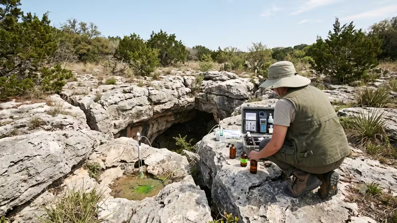
In 2010, the Edwards Aquifer Authority conducted a series of tracer tests in northern Bexar County, injecting nontoxic fluorescent dyes into six caves and monitoring 32 public and private wells to trace groundwater flowpaths. The tests recorded apparent groundwater velocities of up to 5,300 metres per day in the Panther Springs Creek groundwater basin. What they found was startling. In some spots, groundwater raced through the underground limestone at up to 5,300 metres per day, crossing major geological faults along the way, results that reshaped how officials think about protecting a water source that millions of people rely on every single day.Dye dropped into six caves near San AntonioThe Edwards Aquifer recharge zone in northern Bexar County is a karst landscape, where groundwater can move through fractures, conduits and other openings in limestone. Instead of soaking slowly through sand and gravel, water in this region moves through a maze of caves, sinkholes and dissolved limestone passages carved out over millions of years, a type of formation known as karst. To map how water actually travels through that maze, researchers injected fluorescent dyes into six caves within the San Antonio segment of the aquifer, aiming to trace flow paths and estimate velocities in the Panther Springs Creek groundwater basin in northern Bexar County. Detecting where the dye eventually surfaced required a wide net. The monitoring array consisted of 32 public and private wells, including irrigation wells at a local golf club and public water supply wells serving nearby neighbourhoods. This scale of testing meant the team could see not just whether the caves connected to nearby wells, but how quickly and along what routes.Water moved faster than anyone expectedThe results showed just how quickly contamination could spread if it ever entered the system at the wrong spot. Groundwater velocities to one particular well ranged from 1,100 to 5,300 metres per day, while velocities to other wells where dye was detected ranged from 13 to 2,330 metres per day. Just as significant was where that water was travelling from. The dye showed that flow paths between the caves and the monitored wells crossed several faults running northeast to southwest and that faults with displacement of up to 104 metres did not block the movement of groundwater at all. The tracer results also indicated a hydraulic connection between the Edwards Aquifer and the upper part of the underlying Glen Rose Formation within the Upper Trinity Aquifer in the study area. A 2019 Geological Society of America chapter reviewing tracer testing across the Edwards Aquifer shows how widely groundwater velocities can vary between locations. In the Barton Springs segment, earlier tracer tests measured velocities of 915 to 9,150 metres per day, while the 2010 Panther Springs Creek study recorded apparent velocities of 13 to 5,300 metres per day.A warning for a water supply that serves millionsPerhaps the most sobering part of the study had nothing to do with a cave at all. Researchers also released dye at a plain patch of ground with no visible karst features, no sinkhole, no cave entrance, and nothing to suggest it was connected to anything below. Dye still turned up in nearby wells within weeks, showing that vulnerable ground is not limited to the obvious, dramatic-looking openings that most people associate with karst landscapes. That has real consequences for a region where groundwater doubles as the primary drinking supply.A separate study by the US Geological Survey on a nearby well field found that karst features act as fast pathways for contaminants, with almost half the water reaching one public supply well estimated to be less than two years old, leaving little time for natural processes to filter out anything harmful before it reaches a tap. Tracer studies had already been used elsewhere in the Edwards Aquifer for years. The Barton Springs/Edwards Aquifer Conservation District and the City of Austin conducted groundwater tracing in the Barton Springs segment from 1996 through 2000. The 2010 Edwards Aquifer Authority study added a separate set of observations from the Panther Springs Creek basin in northern Bexar County. The findings reinforce why protecting the recharge zone matters: the study showed that groundwater can move rapidly through the subsurface and that contamination risks are not limited to places with obvious caves or sinkholes.Catch the latest World News and Live updates. Download the TOI app.
Topics in this story
Gathered from external sources. Rights to this text belong to whoever originally published it.