In 2004, Madrid began burying nearly 10 kilometres of urban motorway; seven years later, a 120-hectare riverside park covered the traffic tunnels
Rest of World News: Discover how Madrid's M-30 motorway was transformed into the stunning Madrid Río Park, reconnecting neighborhoods and reducing traffic and noise pollution, while enhancing urban green spaces.
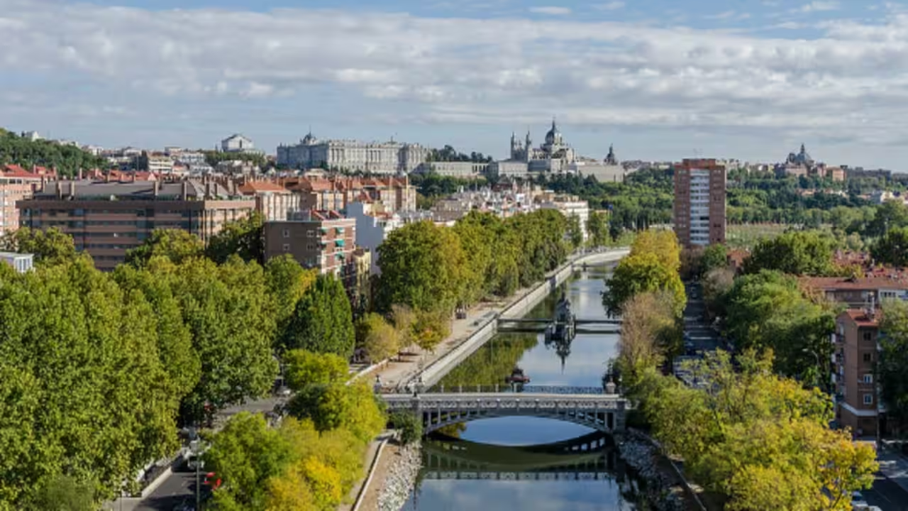
For decades, the M-30 ring road ran along the Manzanares River, cutting Madrid's south-western neighbourhoods off from the water and from one another. The M‑30 reform works (including the riverfront tunnels that enabled Madrid Río) were initiated on 24 September 2004, as recorded by the Ayuntamiento de Madrid and Madrid Calle 30. By 2011, the surface above the tunnels had become Madrid Río, a linear park stretching more than 10 kilometres and covering 120 hectares along the river.Tunnel works begin on a congested ring road in September 2004 This road remains the busiest of Madrid’s three orbital roads, carrying almost 200,000 vehicles a day and accounting for about one-fourth of regional traffic. A sustainability study published in Applied Sciences says the M-30 carried roughly 300,000 vehicles a day before the works and that the south-west stretch concentrated the worst conditions because it ran beside dense neighbourhoods with high noise and pollution levels. It also notes that the 2004 to 2007 tunnelling and cover works were intended to improve safety, reclaim surface space and reconnect the riverfront, rather than simply expand capacityThe reconstruction ran from 2004 to 2007 and moved part of the road underground, creating 8.8 kilometres of tunnels using open-cut construction, screen walls and boring machines for a bypass tunnel. According to the same study, the purpose of this project was to reduce traffic congestion and accidents.A 2005 International Design Competition shapes the parkWhile the tunnels were being built, Madrid’s city council held an international design competition in 2005 for the space above the motorway. The selected design, by architect Ginés Garrido, formed the basis for the Madrid Río project. A separate study on the project's landscape architecture, Parks and Roads Build the Cities: The M-30 and Madrid-Río Project, Building Landscape, presented at the International Conference Virtual City and Territory, describes how the design organised the park into a series of themed gardens along a central pedestrian spine called the Salón de Pinos. The Avenida de Portugal link, for example, uses Portuguese pavement patterns and cherry trees, referencing the pre-existing avenue that was built over, while other sections draw on wetlands, sports terraces and river walks. As the study notes, the project’s main aim was to reconnect neighbourhoods separated by the motorway for decades.Planting and construction covered the buried road from 2007 to 2011 Surface construction on the park ran from 2007 to 2011, following the completion of the tunnels. According to the record kept by the Ayuntamiento de Madrid, the city's own government, more than 33,000 trees, 470,000 shrubs and 210,000 square metres of low-water meadow were planted across the reclaimed surface. The Applied Sciences article further states that the planting scheme was expected to reduce CO2 emissions in comparison to the exposed roadway on the same site, though the precise figure could not be independently verified.The park’s central footpath is about six kilometres long and follows the river, linking Casa de Campo to Parque Lineal del Manzanares and connecting to a 30-kilometre network of segregated cycleways built as part of the same project. New pedestrian bridges, including the Puente Monumental de Arganzuela by architect Dominique Perrault, were built to cross the river where no such crossings existed before.Noise levels fall from above 75 to about 60 decibels The effects of burying the road on noise reduction were evaluated by measuring sound levels above the new tunnels. Before construction began in 2004, noise levels in the area known as the Arganzuela district exceeded 75 decibels. By 2011, once the park above the completed tunnels had opened, noise levels in most of the district had fallen to about 60 decibels, although higher readings remained at the tunnel entrances and exits. Spanish legislation sets a 65-decibel limit for residential zones, so the new readings fell within acceptable levels for the first time in many years. The study also reported that lowering the speed limit from 90 to 70 kilometres per hour for safety reasons reduced carbon dioxide emissions by 15 percent and nitrogen oxide emissions by 16 percent, although nitrogen oxide emissions still exceeded the annual limits set by Spanish law.A 120-hectare park reopens both banks of the river in April 2011 Madrid Río was officially inaugurated on 15 April 2011, almost seven years after the work on the tunnels started. According to official figures from the Ayuntamiento de Madrid, the park covers more than 120 hectares along the river from Puente de los Franceses to south Madrid, with a smaller section extending northwest toward Avenida de Portugal. In addition to the planting and cycling paths, the Ayuntamiento de Madrid added 5,506 benches, 63 water fountains, 33 pedestrian and cyclist crossings and 17 playgrounds. Research in Applied Sciences found a positive economic effect from the park's creation: real estate prices in nearby neighbourhoods rose by about 500 euros per square metre from 2005 to 2015, a period that also spans the 2008 financial crisis and the subsequent collapse and recovery of the Spanish property market. The study associates part of the net increase with the opening of Madrid Río Park and the removal of the former barrier, alongside broader market fluctuations over the decade.Catch the latest World News and Live updates. Download the TOI app.
Topics in this story
Gathered from external sources. Rights to this text belong to whoever originally published it.