A tropical system is likely in the Gulf this week despite El Niño. Here are the latest scenarios
An Atlantic hurricane season squashed by El Niño could come to life.
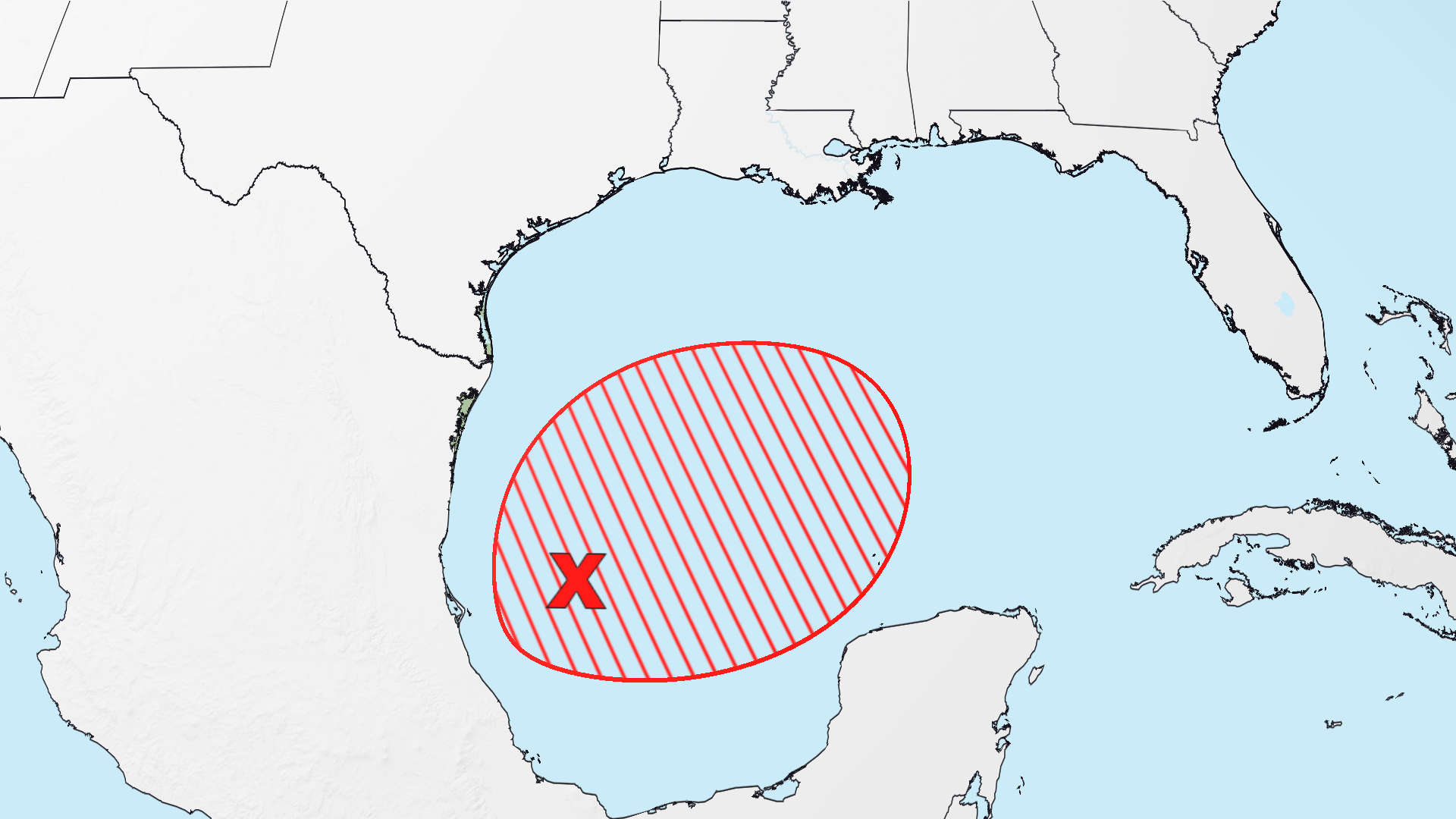
A tropical depression or storm has a high chance to form in the Gulf this week and breathe life into the tail end of an Atlantic hurricane season squashed by El Niño. The Gulf is often a hot bed for late-season storms. Right on cue, chances are increasing for an area of stormy weather festering in the Gulf’s Bay of Campeche to spin up into one by midweek, according to the National Hurricane Center. The next storm name in the Atlantic is Isaias (ees-ah-EE-ahs). Exactly where the storm could track or how strong it could get is still up in the air. Gulf water is record warm for this time of year, primed to generate and help strengthen any system. But this potential storm’s overall strength could be capped by less favorable conditions in the atmosphere. No matter its final fate, heavy rain is a concern on the Gulf Coast and in other parts of the South by late this week. The forecast scenarios All three scenarios are still possible, but it’s looking more likely that a tropical system will form for at least some period of time. As this year has already shown, it doesn’t take a hurricane-strength system to cause significant impacts, particularly in a warming world that’s making tropical systems wetter. Tropical storms Arthur and Edouard didn’t last long, but their heavy rain resulted in significant flash flooding and water rescues. Parts of Louisiana and Mississippi took the brunt of Arthur’s flooding while Edouard dropped over 20 inches of rain in eastern Texas. Parts of Alabama, Georgia, the Florida Panhandle, southeast Louisiana and Mississippi are most at risk of heavy rain from this system. The downpours could start to ramp up along the coast as soon as Friday and then continue to soak the region while creeping farther inland through the weekend. Several inches of rain could fall, but it’s too soon to pinpoint which locations might see the most and could experience flash flooding. What’s typical in October and November Four named storms — that’s tropical storm strength or greater — typically form in October and November, but some hurricane seasons can have a stronger finish while others quiet down. The last few years illustrate this year-to-year ebb and flow. Seven storms formed during October and November in 2024, but just two formed during the same time in 2023. Late-season storms tend to form closer to the United States, including in the Gulf, Caribbean and off the Southeast coast, which makes them more likely to impact land. While there are usually fewer storms, they can still be destructive. Last year, Category 5 Hurricane Melissa devastated Jamaica in October’s final week. Hurricane Michael roared into the Florida Panhandle on October 10, 2018, becoming the latest landfalling Category 5 on record in the US. And Hurricane Sandy may be the most notorious of all: It morphed into a hybrid superstorm in late-October 2012 and walloped the East Coast. Super El Niño’s grip on the Atlantic basin means a repeat of notorious late-season hurricanes is less likely this year. Its storm-killing wind is the main reason this season could go hurricane-free for the first time in reliable records.
Topics in this story
Gathered from external sources. Rights to this text belong to whoever originally published it.