In 1968, Quebec completed the Daniel-Johnson Dam to unite two river systems; 56 years later, Manicouagan still rings a 214 million-year-old crater
Rest of World News: Discover how the Daniel-Johnson Dam transformed Quebec's landscape by uniting two lakes into the iconic 'Eye of Quebec' and its connection to a 214 million-year-old impact crater.
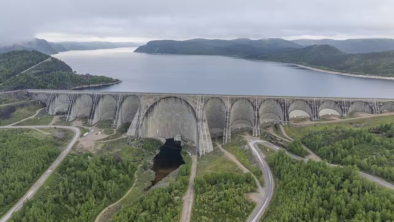
In 1968, Hydro-Québec completed the giant dam which is now known as the Daniel-Johnson Dam on Quebec’s Manicouagan River. The structure altered the landscape around one of Earth’s most recognisable impact sites: a crater formed around 214 million years ago. However, the circular Manicouagan Reservoir that is visible today did not exist when the dam was completed. Before the construction, two separate crescent-shaped lakes occupied parts of the ancient crater, and as water levels continued to rise after the completion of the dam, those previously separated water bodies joined, eventually forming the ring-shaped reservoir known as the “Eye of Quebec.”A crater created long before Quebec even existedAccording to the US Geological Survey, the resulting impact crater is now about 214 million years old. Furthermore, NASA estimates that the impact created a structure roughly 100 kilometres across, with a prominent central uplift surrounded by a ring-shaped depression. Gradually, erosion and glacial activity altered the structure, but the crater’s original geological pattern remains visible even today.The modern lake, however, is far younger than the crater itself. Before the hydroelectric project, two separate crescent-shaped lakes occupied the impact structure: Manicouagan Lake on the eastern side and Mouchalagane Lake on the western side. NASA explained that these were isolated water bodies before the completion of the Daniel-Johnson Dam in 1968. The two histories overlap in the landscape, but they occurred on vastly different timescales, as one dates back millions of years and the other is a product of Quebec’s 20th-century hydroelectric development.How the Daniel-Johnson Dam changed the area’s landscapeHydro-Québec began constructing the Manic-5 dam in the 1960s as part of the Manic-Outardes hydroelectric project. As per Hydro-Québec’s records, the dam required approximately 31.35 million man-hours of work and contains 13 arches and 14 buttresses, standing a maximum of 214 metres tall, while stretching about 1.3 kilometres across the Manicouagan River. NASA reported that following the dam’s completion, water levels gradually rose, causing the two previously separate lakes to merge into the Manicouagan Reservoir. Meanwhile, Hydro-Québec’s records show that reservoir filling took several years, from construction through 1977. That chronology makes the sequence clear: the dam was completed in 1968, initiating a multi-year flooding process that closed the circular shoreline loop by 1972, though the entire basin did not finish accumulating its total volume until 1977.Eventually, the reservoir expanded to submerge approximately 1,940 square kilometres, thus completely isolating the crater’s central uplift to form René-Levasseur Island. According to NASA data, the completed basin reaches a maximum depth of 350 metres and holds roughly 140 cubic kilometres of water, making it one of Canada’s most prominent inland water bodies.Additionally, the dam itself is considered an engineering landmark, with Quebec’s official toponymy service describing the Daniel-Johnson structure as the world’s largest multiple-arch-and-buttress dam. Although the dam was completed in 1968, its planned inauguration in September of the same year was postponed after Quebec Premier Daniel Johnson died at the site on 26 September. The formal inauguration took place a year later in 1969, and the dam was named in his honour.Transformation from two separate lakes to the “Eye of Quebec”The transformation can be seen clearly through satellite imagery. The USGS’s 2024 “Eye of Quebec” feature compares a declassified 1964 Project Argon Image with a 2024 Landsat 8 image. The earlier image shows the two crescent-shaped lakes before the reservoir existed in its present form; meanwhile, the modern image showcases the large circular lake surrounding René-Levasseur Island. By 1972, Landsat imagery confirmed that the rising waters had breached the crater's dividing topography to form the iconic circular perimeter seen today. While this initial surface shoreline was established early, it required five additional years of continuous vertical rise, until 1977, for the massive basin to submerge remaining internal high points, reach its operational pool depth, and achieve maximum volumetric storage capacity.Catch the latest World News and Live updates. Download the TOI app.
Topics in this story
Gathered from external sources. Rights to this text belong to whoever originally published it.