8 leaf-peeping destinations that belong on your fall travel list
From Nevada's high-mountain aspens to Kentucky's sandstone gorges, these autumn escapes prove brilliant color isn't limited to New England.
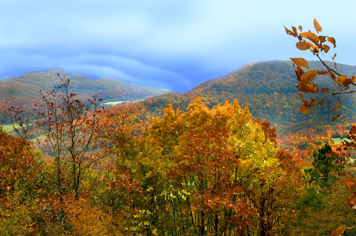
When people talk about fall foliage, certain destinations tend to dominate the conversation. Vermont and New Hampshire have their maple-covered mountains, while Colorado's golden aspens draw leaf peepers into the Rockies each September. The Blue Ridge Parkway and Great Smoky Mountains aren't exactly secrets, either.
But deciduous trees grow in plenty of places that haven't built entire tourism industries or a national reputation around their annual color change. Some of the country's most interesting fall landscapes can be found in the sandstone gorges of Ohio and Kentucky, the lake country of northern Minnesota and even the mountains of Nevada.
The following 8 destinations aren't necessarily undiscovered — locals certainly know what happens when the leaves begin to turn — but they remain surprisingly overlooked on the national fall travel circuit. Better yet, there's plenty to do once you arrive besides stare at trees.
The Ozarks are one of the country's most overlooked regions for fall color. The rugged Boston Mountains of northwestern Arkansas are covered in oak, maple, hickory, sassafras and other hardwoods that turn shades of yellow, orange, red and even a little purple if you look hard enough. Better yet for procrastinating leaf peepers, the show arrives relatively late — color generally begins appearing by the second week of October and peaks in late October, extending into early November.
A great way to explore is behind the wheel. The Pig Trail Scenic Byway twists through heavily forested mountains along Arkansas Highway 23, while the Boston Mountains Scenic Loop crosses the range through deep valleys and high ridges with sweeping views across the Ozarks.
But plan to spend some time outside the car too. Devil's Den State Park has miles of hiking and mountain biking trails through sandstone bluffs, caves and narrow ravines, while Ozark National Forest offers everything from short walks to longer hikes into the backcountry. Farther east, the Buffalo National River flows beneath limestone bluffs through the heart of the Ozarks.
Ohio doesn't have much of a national reputation for dramatic landscapes, which is part of what makes a first visit to Hocking Hills so surprising. About an hour southeast of Columbus, the region is carved into sandstone cliffs, narrow gorges, waterfalls and caves surrounded by thick forest. Unlike much of Ohio, this corner of the state escaped the flattening effects of the Ice Age glaciers. Instead, over millions of years, streams cut through the region's sandstone, creating the rugged landscape visitors see today.
Those formations make the fall color particularly interesting. Trails descend into narrow gorges where hemlocks remain dark green beneath sandstone cliffs; hardwoods, meanwhile, turn crimson overhead. The classic hike follows the gorge from Old Man's Cave toward Cedar Falls , passing beneath rock overhangs and alongside streams and waterfalls. Ash Cave, Conkle's Hollow and Rock House offer more chances to explore the cliffs, recess caves and forested ravines that make Hocking Hills unlike much of the surrounding Midwest.
Fall color typically peaks around the middle of October. Beyond the best-known trails, spend some time exploring the surrounding back roads that lead to Wayne National Forest — check out the Wildcat Hollow Trail , which is particularly good in the fall. Lake Logan offers paddling and fishing beneath the changing trees.
Nevada isn't the first state that comes to mind for leaf-peeping — makes sense, considering much of it is desert terrain. But among the exceptions is Great Basin National Park , where Wheeler Peak Scenic Drive climbs from the desert near the Utah border to more than 10,000 feet above sea level. Sagebrush and pinyon-juniper woodland give way to mountain forest, and near the top of the road, groves of aspens spread across the slopes of the Snake Range. In the fall, they turn yellow, red, and gold.
Explore Wheeler Peak Scenic Drive — which climbs more than 4,000 vertical feet in 12 miles — then hike the Alpine Lakes Loop or take the Bristlecone Trail to a grove of ancient Great Basin bristlecone pines beneath Wheeler Peak, where some trees are thousands of years old. Below ground, ranger-led tours explore the stalactites and stalagmites of Lehman Caves. Stick around after dark too: Great Basin's remote location and exceptionally dark skies make it one of the better places for stargazing .
Aspens generally begin changing around the second or third week of September, with timing varying by elevation and weather. The upper Wheeler Peak Scenic Drive is typically accessible through October, but snow can close it earlier — a reminder that despite the Nevada address, this is very much a high-mountain fall trip.
California has the highest mountains in the Lower 48, but it rarely enters the national leaf-peeping conversation. Why? Some things in life are just strange. Head east of the Sierra Nevada in the fall and you'll be in on the secret.
The town of Bishop makes a good base. Roads climb west from the Owens Valley into Bishop Creek Canyon , where groves of aspen grow around creeks and alpine lakes beneath the steep granite walls of the Sierra Nevada. North Lake, Lake Sabrina and South Lake are among the most reliable stops, with the color gradually working its way down from the high country from late September through late October.
Spend a day hiking or driving Bishop Creek, but leave time for Highway 395 — it showcases mountains rising abruptly from the desert. North of Bishop, the road follows the eastern wall of the Sierra toward Mammoth Lakes, with easy detours into mountain canyons along the way. Stop at Convict Lake for a short hike around the water beneath a wall of steep, exposed peaks, or continue into the Mammoth Lakes Basin for more trails and groves of changing aspen.
Lake Superior's North Shore gets plenty of attention during Minnesota's fall color season, but a lesser-known road heads inland from Grand Marais. The Gunflint Trail runs nearly 60 miles through Superior National Forest toward the Canadian border and the edge of the Boundary Waters, passing rocky ridges and dozens of lakes along the way. This is classic North Woods country, with spruce and pine forests broken up by birch, maple and aspen that light up with color each fall.
Driving the Gunflint is worthwhile, but hiking and paddling are recommended. Canoe one of the many lakes along the route or climb Honeymoon Bluff to a rocky overlook above Hungry Jack Lake and the surrounding forest. Farther up the trail, the Magnetic Rock Trail crosses open bedrock and boreal forest on its way to a large, iron-rich rock with enough magnetism to move a compass needle. For a bigger adventure, the Gunflint also provides several entry points into the Boundary Waters Canoe Area Wilderness .
Timing can vary considerably, even over short distances in northern Minnesota, but the Gunflint Trail is often strongest from late September into early October. Because wildfires affected parts of Superior National Forest in 2026, check current closures and conditions before heading into the Boundary Waters.
Most travelers visit the Black Hills in summer, when Mount Rushmore and the region's winding scenic roads are at their busiest. Fall provides a compelling reason to wait. Spearfish Canyon cuts through the northern Black Hills between high limestone walls, with Spearfish Creek running alongside the road and waterfalls tucked into side canyons. Spruce and ponderosa pine keep much of the landscape green while aspens, birches and other deciduous trees change colors.
The canyon is only one piece of the trip. Continue south through the Black Hills to Custer State Park , where the 18-mile Wildlife Loop Road passes through rolling prairie and pine forest inhabited by bison, pronghorn, elk and bighorn sheep. Needles Highway winds through some of the region's granite spires, and hikers can climb Black Elk Peak, the highest point in South Dakota, for views across the surrounding hills.
Color typically peaks from late September into early October, which is also a good time to visit Mount Rushmore. The memorial remains open throughout October, while the enormous summer crowds begin to taper off after Labor Day.
The Pennsylvania Wilds stretch across a huge swath of sparsely populated northern Pennsylvania. Hardwood forest covers much of the region, turning the rolling hills and river valleys red, orange and gold in early October. It's a big landscape by eastern standards, with enough public land to string together several days of hiking, scenic drives and wildlife watching.
Allegheny National Forest is a great place to start. The 36-mile Longhouse National Scenic Byway loops through oak, black cherry and hemlock forest around the Allegheny Reservoir, with stops at Rimrock and Jakes Rocks for views across the water and surrounding hills. Jakes Rocks also has more than 35 miles of mountain-bike trails, and the reservoir itself opens up another way to see the foliage by kayak or canoe.
Farther east, Kinzua Bridge State Park contains an intriguing landmark: the remains of a massive railroad viaduct, partially destroyed by a tornado in 2003 and repurposed as a pedestrian skywalk. From there, you can look across the Kinzua Creek Valley, where foliage generally peaks during the first two weeks of October. (The skywalk will remain open through Oct. 31, 2026, while a larger rehabilitation project continues.) Fall also overlaps with the elk rut, and the area around Benezette is one of the best places in the Pennsylvania Wilds to see and hear bugling bull elk.
Kentucky has bourbon and horse country pretty well covered from a tourism standpoint, but its fall foliage tends to get less attention. That's a shame in the Red River Gorge, where one of the East's more unusual landscapes sits within Daniel Boone National Forest . Sandstone cliffs and natural arches rise above a heavily wooded network of ravines and ridges. In October, the fall color makes the geology come to life even more.
For a first visit, hike to Gray's Arch or choose one of the trails along Auxier Ridge, where viewpoints look across miles of forest and sandstone formations. Natural Bridge State Resort Park is nearby, and the Red River Gorge Scenic Byway offers an easier way to see the landscape by car.
Color usually reaches its best from mid-to-late October, when cooler temperatures make it an ideal time to spend long days outdoors. And there is plenty left to discover. More than 100 natural sandstone arches are scattered throughout the Red River Gorge Geological Area — go and see as many as you can.
Topics in this story
Gathered from external sources. Rights to this text belong to whoever originally published it.