A coal millionaire donated 3,654 acres to Pennsylvania in 1969; the state spent $1.7 million reclaiming mining-scarred land to create Hillman State Park
In 1969, James F. Hillman, president of the Harmon Creek Coal Corporation, donated 3,654 acres to the Commonwealth of Pennsylvania for outdoor recreation.
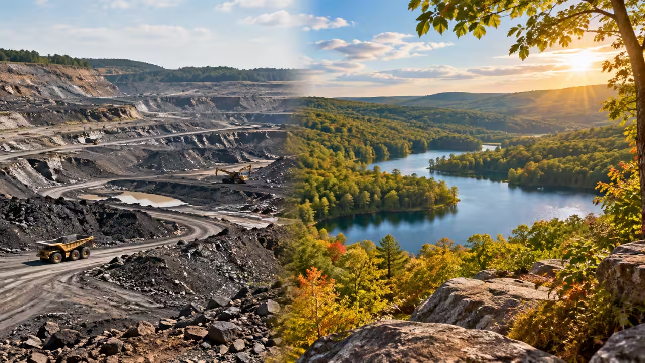
In 1969, James F. Hillman, president of the Harmon Creek Coal Corporation, donated 3,654 acres to the Commonwealth of Pennsylvania for outdoor recreation. According to the Pennsylvania Department of Conservation and Natural Resources (DCNR), the gift was reported at the time to be the largest single land donation for a state park in the country, valued at more than one million dollars. The land had been used for oil drilling and coal strip mining, and known abandoned mine drainage problems existed on the site. From 1970 through 1977, the state spent $1.7 million on reclamation projects at Hillman State Park.How did a coal millionaire’s 3,654 acres become a Pennsylvania state parkSettlement in the region was limited because of continued conflicts between settlers and Native Americans, and settlements were frequently attacked over land ownership disputes. Many settlers built forts made up of a central structure surrounded by a stockade. Matthew Dillow settled the land along Dilloe Run in the northern edge of the present park and, with other settlers, built Dillow's Fort in 1779. The fort was built along a Native American path that ran north and south through the area, as was Fort Dugan, located six miles north in what is now Raccoon Creek State Park. Matthew Dillow was killed during an attack on the fort in 1782, and the DCNR says peaceful occupation of the region did not come until the end of the 1700s, with much of the area given over to farming.Abundant mineral resources were discovered during the 1880s, and many farmers gave up agriculture for what the page calls a more prosperous opportunity. The Citizens Fuel Company drilled the first gas wells in the area. Oil was discovered near the centre of the park in 1885, and the boomtown of Five Points was born. According to the DCNR, a significant portion of the Florence-Five Points Oil Field lies under the park and was once one of the most prolific oil fields in southwestern Pennsylvania. The South Penn Oil Company drilled more than 170 oil wells in the park, most of which are now abandoned. The DCNR adds that there are currently 28 active wells owned by the Cassidy Oil Company of Florence.How did a coal company plant more than two million trees on mining-scarred landJohn A. Bell began strip mining for coal in a small area within the park in 1914, and that J.R. Elec operated a 17-acre deep mine along the southern edge of the park during the 1920s. The nearby Florence Mine was purchased in 1928 by the Harmon Creek Coal Corporation, which began buying the land that is now the state park in 1932. This was the largest bituminous coal strip mine in Pennsylvania, with more than 15 million tons of coal removed by 1968. The company built and maintained private roads to haul coal, and some of them can still be seen and are used to access the park. After the Second World War, augers were used for mining, and the former village of Five Points was eliminated during these operations.The company considered reclamation an integral part of coal mining and began conservation practices in 1937, well before the practice became law. The first statute passed in Harrisburg requiring only partial restoration came in 1945. The company's conservation department pioneered the restoration of strip-mined land, and restoration plans were made two years before an area was mined. Those plans included reusing stockpiled topsoil, contouring the land, adding fertiliser and planting a cover crop. According to the DCNR, the company ran a nursery that provided 30,000 pine, oak, ash, larch, chestnut and multiflora rose seedlings each year. By the late 1960s, more than two million trees had been planted in the southern end of the park, and grasses, clover and vetch had been planted in the northern and western sections. The company's wildlife programme included food plots of corn, sorghum and sunflowers, the stocking of pheasants for hunting, and the stocking of fish in the lakes and ponds.How did a coal millionaire’s 3,654-acre gift become a Pennsylvania state parkThe property became a state park in 1969, when James F. Hillman, president of the Harmon Creek Coal Corporation, donated 3,654 acres to the Commonwealth of Pennsylvania for outdoor recreational purposes. At the time, the donation was reported to be the largest single land gift for a state park in the country and was valued at more than one million dollars. As part of the planning process for the park, an Operation Scarlift Report was completed because of known abandoned mine drainage problems on the site. The DCNR explains that Operation Scarlift was part of the Land and Water Conservation and Reclamation Fund, authorised in 1967 for the elimination of land and water scars created by past coal mining practices.The Department of Environmental Resources, now the DCNR, spent $1.7 million from 1970 through 1977 to complete reclamation projects at Hillman State Park. The work covered filling, grading, erosion control, soil treatment with fly ash and additional plantings. The DCNR's account therefore links the park's creation to two separate efforts: the company's earlier conservation practices and the state-funded reclamation that followed the donation.1949 model aeroplane field become a Pennsylvania state park airportIn 1949, an engineering student from the University of Pittsburgh asked James F. Hillman for a place to fly model aeroplanes. Mr Hillman contributed a 20-acre fenced area at the southern end of the park, which had a two-section field, a 200-foot asphalt runway, an operations building and a public address system. It was called Hillman's Model Wing Airport. The airfield closed in 1977, and a new one was built at the northern end of the park. It was named after K. Leroy Irvis, an aviation and model aeroplane enthusiast and a former state representative and Speaker of the House, who helped obtain funding for the project. The DCNR says the K. Leroy Irvis Radio Control Model Airport is ADA accessible and includes a covered shelter, asphalt runways and taxiways, asphalt and grass pit areas, wind sock poles, a frequency board, a parking area and a spectator area.The airport is operated and maintained by the Greater Pittsburgh Aero Radio Control Society, a chartered club of the Academy of Model Aeronautics (AMA). All users must have an FCC license, maintain and display a current AMA membership, and preregister with Raccoon Creek State Park, which can be contacted at 724-899-2200. The park's history page also records the Lyle Covered Bridge, built in 1887. It is a 38-foot queen post truss bridge on Kramer Road that crosses Brush Run at the eastern border of the park. It is listed on the National Register of Historic Places, is owned by Washington County and is open to vehicles and pedestrians.You use AI every day. Now get your AI Quotient. Take the AIQ test.
Topics in this story
Gathered from external sources. Rights to this text belong to whoever originally published it.