In 2023, archaeologists using Cold War satellite images found 396 previously unrecorded Roman forts across Syria and Iraq, challenging an old theory about the empire’s eastern frontier
Rest of World News: In 2023, Cold War satellite images revealed 396 previously unknown Roman forts across Syria and Iraq, challenging long-held ideas about Rome’s eastern frontier
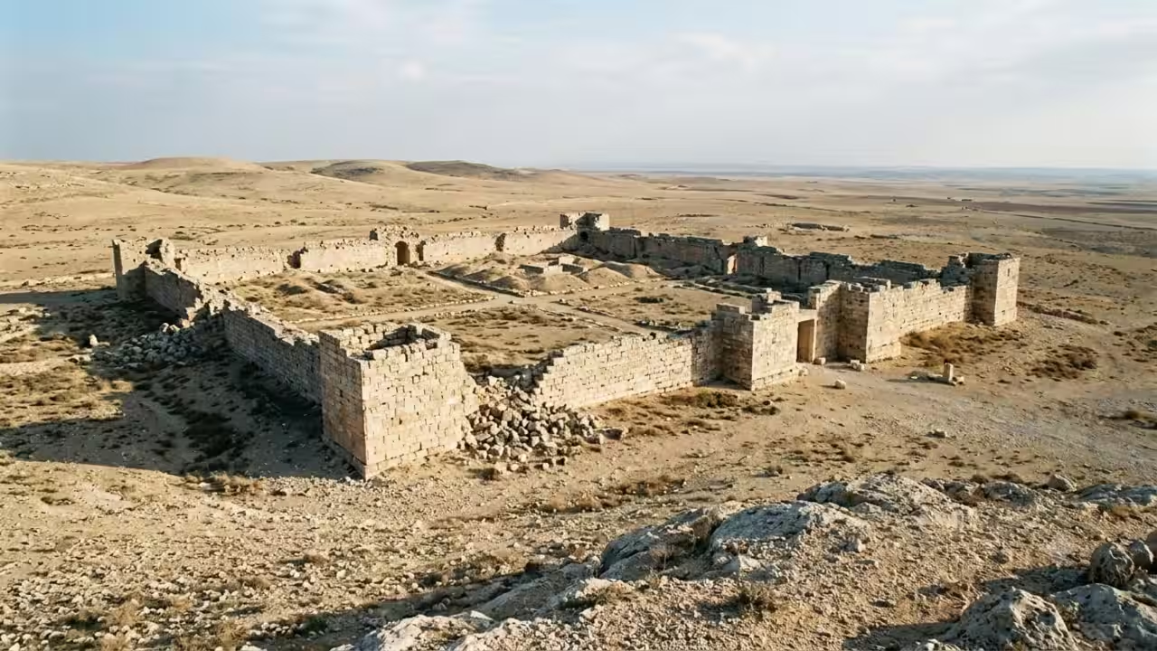
For over a century, the narrative of the eastern frontier of the Roman Empire was based almost solely on the observations of a single French priest flying a biplane during World War One across the Middle Eastern deserts. Based on aerial surveys conducted in the 1920s and 1930s, Father Antoine Poidebard concluded that the 116 fortified buildings dispersed throughout the area formed a defensive line that ran roughly north to south, creating a permanent military border between Rome and her eastern adversaries. Even as more potent techniques for observing the ancient landscape finally became available, generations of historians generally accepted that interpretation.An unlikely source, declassified satellite images from the Cold War, initially collected for military intelligence objectives rather than archaeology, challenged the frontier theory Poidebard had proposed decades earlier. Dartmouth College archaeologist Jesse Casana and colleagues leveraged imagery from the American CORONA and HEXAGON satellite programmes, acquired between 1960 and 1986 and made publicly available decades after being captured for reconnaissance at the height of Cold War tensions. The images are from before much rapid urbanisation, agricultural growth and decades of conflict in the region; thus, they preserve a depiction of the environment far closer to its ancient state than anything seen in recent satellite shots.Thousands of images, hundreds of fortsThe team subdivided their study zone, a roughly 300,000 square kilometre swathe of the northern Fertile Crescent running from western Syria into northwestern Iraq, into manageable grid squares and visually analysed more than 2,000 satellite photographs for the distinctive square or rectangular imprints of Roman fortifications. Of the 116 forts originally identified by Poidebard, the team could only find 38 in the satellite picture, showing how much of the historic landscape had already been wiped out by decades of current land use change. Using those proven sites as a reference point, the team then combed through that imagery at a finer grid resolution, ultimately screening more than 10,000 probable archaeological features across the full study zone, then trimmed the list to 396 previously unrecorded forts or fort-like structures based on uniform parameters for size and shape.It turned out that the distribution of these newly recognised forts told a remarkably different story than the one Poidebard had proposed. Instead of a defensive line running north to south, the constructions extend far to the east and west, connecting the city of Mosul on the Tigris River with Aleppo in western Syria. That pattern suggested the forts were never intended to be an inflexible military barrier dividing Rome from hostile land to the east but instead functioned more like waypoints supporting trade caravans, troop movements and communication across a fluid frontier zone shared with Parthian and later Sasanian powers. The journal Antiquity has published the full findings.A record that vanished, saved barely in timeWhat makes the discovery particularly remarkable is how much of this material has since vanished altogether from the visible landscape. Many of the forts indicated in the older satellite imagery are nowhere to be seen in present-day shots, having been destroyed or buried under decades of urban expansions, reservoir construction, agricultural expansion and the physical damage inflicted by regional conflict. The declassified imagery utilised in this study forms part of the wider Atlas Project, an open access internet resource that has made thousands of Cold War era satellite photographs available to scholars investigating ancient landscapes across the Middle East and beyond.The research substantially changes long-held notions about how the Roman Empire administered its eastern edge, revealing a frontier far more porous and financially connected than the constructed wall-like barrier that historians had envisaged for over a century. It also points to the growing value of using military intelligence archives for historical research, as imagery taken to monitor Soviet military installations has instead provided an irreplaceable view of a vanished world of antiquity, recorded just before so much of it disappeared forever under the sands and cities of the modern Middle East.Catch the latest World News and Live updates. Download the TOI app.
Topics in this story
Gathered from external sources. Rights to this text belong to whoever originally published it.